Monteview Topo Map Idaho
To zoom in, hover over the map of Monteview
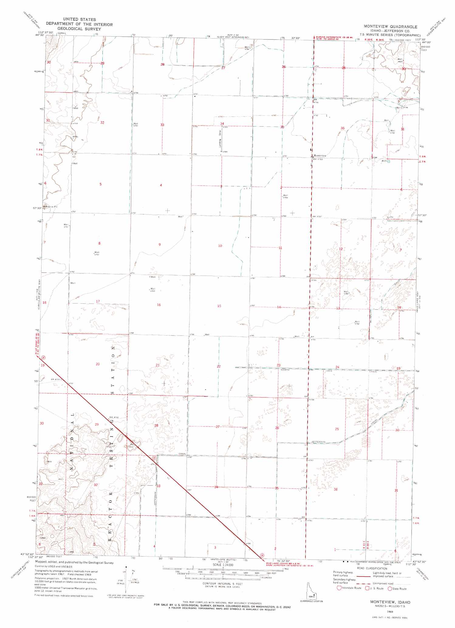
USGS Topo Quad 43112h5 - 1:24,000 scale
| Topo Map Name: | Monteview |
| USGS Topo Quad ID: | 43112h5 |
| Print Size: | ca. 21 1/4" wide x 27" high |
| Southeast Coordinates: | 43.875° N latitude / 112.5° W longitude |
| Map Center Coordinates: | 43.9375° N latitude / 112.5625° W longitude |
| U.S. State: | ID |
| Filename: | o43112h5.jpg |
| Download Map JPG Image: | Monteview topo map 1:24,000 scale |
| Map Type: | Topographic |
| Topo Series: | 7.5´ |
| Map Scale: | 1:24,000 |
| Source of Map Images: | United States Geological Survey (USGS) |
| Alternate Map Versions: |
Monteview ID 1969, updated 1973 Download PDF Buy paper map Monteview ID 2010 Download PDF Buy paper map Monteview ID 2013 Download PDF Buy paper map |
1:24,000 Topo Quads surrounding Monteview
Copper Mountain |
Shamrock Gulch |
Lidy Hot Springs |
Small |
Lone Butte |
Scott Butte |
Snaky Canyon |
Lidy Hot Springs Se |
Cedar Butte Sw |
Cedar Butte |
Richard Butte |
Circular Butte Nw |
Monteview |
Mud Lake Nw |
Rays Lake |
Big Lost River Sinks |
Circular Butte |
Antelope Butte |
Terreton |
Mud Lake Se |
Circular Butte 3 Ne |
Little Butte Nw |
Little Butte Ne |
Kettle Butte Nw |
Kettle Butte Ne |
> Back to 43112e1 at 1:100,000 scale
> Back to 43112a1 at 1:250,000 scale
> Back to U.S. Topo Maps home
Monteview topo map: Gazetteer
Monteview: Canals
McKevitt Ditch elevation 1461m 4793′North Lake Canal elevation 1459m 4786′
Monteview: Populated Places
Monteview elevation 1461m 4793′Monteview digital topo map on disk
Buy this Monteview topo map showing relief, roads, GPS coordinates and other geographical features, as a high-resolution digital map file on DVD: