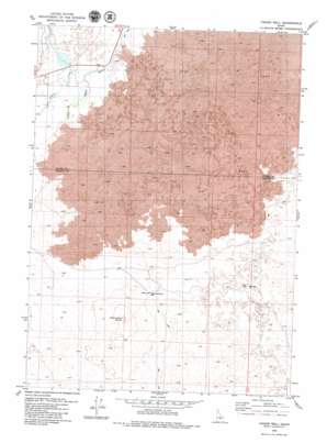
Pagari Well Topo Map Idaho
To zoom in, hover over the map of Pagari Well
USGS Topo Quad 43113b8 - 1:24,000 scale
| Topo Map Name: | Pagari Well |
| USGS Topo Quad ID: | 43113b8 |
| Print Size: | ca. 21 1/4" wide x 27" high |
| Southeast Coordinates: | 43.125° N latitude / 113.875° W longitude |
| Map Center Coordinates: | 43.1875° N latitude / 113.9375° W longitude |
| U.S. State: | ID |
| Filename: | o43113b8.jpg |
| Download Map JPG Image: | Pagari Well topo map 1:24,000 scale |
| Map Type: | Topographic |
| Topo Series: | 7.5´ |
| Map Scale: | 1:24,000 |
| Source of Map Images: | United States Geological Survey (USGS) |
| Alternate Map Versions: |
Pagari Well ID 1979, updated 1979 Download PDF Buy paper map Pagari Well ID 2010 Download PDF Buy paper map Pagari Well ID 2013 Download PDF Buy paper map |
1:24,000 Topo Quads surrounding Pagari Well
> Back to 43113a1 at 1:100,000 scale
> Back to 43112a1 at 1:250,000 scale
> Back to U.S. Topo Maps home
Pagari Well topo map: Gazetteer
Pagari Well: Streams
Silver Creek elevation 1430m 4691′Pagari Well: Summits
Monument Butte elevation 1484m 4868′Pagari Well: Wells
Monument Butte Well elevation 1430m 4691′Pagari Well elevation 1439m 4721′
Pagari Well digital topo map on disk
Buy this Pagari Well topo map showing relief, roads, GPS coordinates and other geographical features, as a high-resolution digital map file on DVD:


