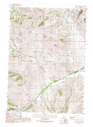
Miller Peak Topo Map Idaho
To zoom in, hover over the map of Miller Peak
USGS Topo Quad 43113f6 - 1:24,000 scale
| Topo Map Name: | Miller Peak |
| USGS Topo Quad ID: | 43113f6 |
| Print Size: | ca. 21 1/4" wide x 27" high |
| Southeast Coordinates: | 43.625° N latitude / 113.625° W longitude |
| Map Center Coordinates: | 43.6875° N latitude / 113.6875° W longitude |
| U.S. State: | ID |
| Filename: | o43113f6.jpg |
| Download Map JPG Image: | Miller Peak topo map 1:24,000 scale |
| Map Type: | Topographic |
| Topo Series: | 7.5´ |
| Map Scale: | 1:24,000 |
| Source of Map Images: | United States Geological Survey (USGS) |
| Alternate Map Versions: |
Miller Peak ID 1991, updated 1991 Download PDF Buy paper map Miller Peak ID 2011 Download PDF Buy paper map Miller Peak ID 2013 Download PDF Buy paper map |
| FStopo: | US Forest Service topo Miller Peak is available: Download FStopo PDF Download FStopo TIF |
1:24,000 Topo Quads surrounding Miller Peak
> Back to 43113e1 at 1:100,000 scale
> Back to 43112a1 at 1:250,000 scale
> Back to U.S. Topo Maps home
Miller Peak topo map: Gazetteer
Miller Peak: Populated Places
Antelope (historical) elevation 1919m 6295′Miller Peak: Springs
Big Spring elevation 1996m 6548′Miller Peak: Streams
Bear Creek elevation 1962m 6437′Camp Creek elevation 2013m 6604′
Horsethief Creek elevation 2061m 6761′
Iron Bog Creek elevation 2073m 6801′
Lake Creek elevation 1939m 6361′
Leadbelt Creek elevation 1994m 6541′
Left Fork Bear Creek elevation 2240m 7349′
Left Fork Cherry Creek elevation 1985m 6512′
McKey Creek elevation 1951m 6400′
Middle Fork Bear Creek elevation 2210m 7250′
Pine Creek elevation 1999m 6558′
Poison Creek elevation 1915m 6282′
Right Fork Bear Creek elevation 2207m 7240′
Slim Creek elevation 2086m 6843′
Willow Creek elevation 1928m 6325′
Miller Peak: Summits
Bear Creek Summit elevation 2410m 7906′Miller Peak elevation 2605m 8546′
Reserve Mountain elevation 2526m 8287′
Miller Peak: Valleys
Bailey Corral Canyon elevation 1915m 6282′Box Bailey Corral Canyon elevation 2043m 6702′
Burnt Hollow elevation 1951m 6400′
Coyote Canyon elevation 2049m 6722′
Death Canyon elevation 2067m 6781′
Dry Canyon elevation 2003m 6571′
Flower Garden elevation 1951m 6400′
Larkspur Canyon elevation 2069m 6788′
Left Fork Death Canyon elevation 2143m 7030′
Little Rough Canyon elevation 2026m 6646′
Mahogany Gulch elevation 2032m 6666′
Marcroft Canyon elevation 2023m 6637′
Mountain Spring Canyon elevation 1915m 6282′
Right Fork Death Canyon elevation 2144m 7034′
Rough Canyon elevation 1927m 6322′
Stoddard Gulch elevation 1923m 6309′
Telephone Gulch elevation 2218m 7276′
Miller Peak digital topo map on disk
Buy this Miller Peak topo map showing relief, roads, GPS coordinates and other geographical features, as a high-resolution digital map file on DVD:


