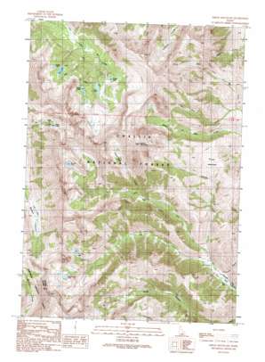
Smiley Mountain Topo Map Idaho
To zoom in, hover over the map of Smiley Mountain
USGS Topo Quad 43113f7 - 1:24,000 scale
| Topo Map Name: | Smiley Mountain |
| USGS Topo Quad ID: | 43113f7 |
| Print Size: | ca. 21 1/4" wide x 27" high |
| Southeast Coordinates: | 43.625° N latitude / 113.75° W longitude |
| Map Center Coordinates: | 43.6875° N latitude / 113.8125° W longitude |
| U.S. State: | ID |
| Filename: | o43113f7.jpg |
| Download Map JPG Image: | Smiley Mountain topo map 1:24,000 scale |
| Map Type: | Topographic |
| Topo Series: | 7.5´ |
| Map Scale: | 1:24,000 |
| Source of Map Images: | United States Geological Survey (USGS) |
| Alternate Map Versions: |
Smiley Mountain ID 1991, updated 1991 Download PDF Buy paper map Smiley Mountain ID 2011 Download PDF Buy paper map Smiley Mountain ID 2013 Download PDF Buy paper map |
| FStopo: | US Forest Service topo Smiley Mountain is available: Download FStopo PDF Download FStopo TIF |
1:24,000 Topo Quads surrounding Smiley Mountain
> Back to 43113e1 at 1:100,000 scale
> Back to 43112a1 at 1:250,000 scale
> Back to U.S. Topo Maps home
Smiley Mountain topo map: Gazetteer
Smiley Mountain: Flats
Smiley Meadows elevation 2578m 8458′Smiley Mountain: Lakes
Golden Lake elevation 2974m 9757′Smiley Mountain: Reservoirs
Big Lake elevation 2968m 9737′Brockie Lake elevation 3023m 9917′
Fishpole Lake elevation 2830m 9284′
Green Lake elevation 2938m 9639′
Iron Bog Lake elevation 2763m 9064′
Long Lake elevation 2891m 9484′
Rough Lake elevation 2933m 9622′
Round Lake elevation 2866m 9402′
Smiley Mountain: Streams
Grasshopper Creek elevation 2488m 8162′Left Fork Iron Bog Creek elevation 2160m 7086′
Lone Pine Creek elevation 2356m 7729′
Right Fork Iron Bog Creek elevation 2159m 7083′
Smiley Creek elevation 2226m 7303′
Smiley Mountain: Summits
Smiley Mountain elevation 3483m 11427′Smiley Mountain: Swamps
Iron Bog Swamp elevation 2195m 7201′Smiley Mountain: Valleys
Big Canyon elevation 2138m 7014′Smiley Mountain digital topo map on disk
Buy this Smiley Mountain topo map showing relief, roads, GPS coordinates and other geographical features, as a high-resolution digital map file on DVD:


