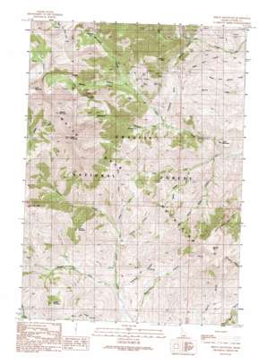
Shelly Mountain Topo Map Idaho
To zoom in, hover over the map of Shelly Mountain
USGS Topo Quad 43113g6 - 1:24,000 scale
| Topo Map Name: | Shelly Mountain |
| USGS Topo Quad ID: | 43113g6 |
| Print Size: | ca. 21 1/4" wide x 27" high |
| Southeast Coordinates: | 43.75° N latitude / 113.625° W longitude |
| Map Center Coordinates: | 43.8125° N latitude / 113.6875° W longitude |
| U.S. State: | ID |
| Filename: | o43113g6.jpg |
| Download Map JPG Image: | Shelly Mountain topo map 1:24,000 scale |
| Map Type: | Topographic |
| Topo Series: | 7.5´ |
| Map Scale: | 1:24,000 |
| Source of Map Images: | United States Geological Survey (USGS) |
| Alternate Map Versions: |
Shelly Mountain ID 1991, updated 1991 Download PDF Buy paper map Shelly Mountain ID 2011 Download PDF Buy paper map Shelly Mountain ID 2013 Download PDF Buy paper map |
| FStopo: | US Forest Service topo Shelly Mountain is available: Download FStopo PDF Download FStopo TIF |
1:24,000 Topo Quads surrounding Shelly Mountain
> Back to 43113e1 at 1:100,000 scale
> Back to 43112a1 at 1:250,000 scale
> Back to U.S. Topo Maps home
Shelly Mountain topo map: Gazetteer
Shelly Mountain: Mines
Champion Mine elevation 2587m 8487′Shelly Mountain: Ranges
White Knob Mountains elevation 2458m 8064′Shelly Mountain: Streams
Blue Rock elevation 2227m 7306′Carcass Creek elevation 2138m 7014′
Lupine Creek elevation 2131m 6991′
Middle Fork Cherry Creek elevation 2035m 6676′
Mud Lake elevation 2131m 6991′
Trail Creek elevation 2047m 6715′
Shelly Mountain: Summits
Big Flat Top elevation 2855m 9366′Lime Mountain elevation 3379m 11085′
Middle Mountain elevation 2632m 8635′
Redbird Mountain elevation 3393m 11131′
Round Mountain elevation 2725m 8940′
Shelly Mountain elevation 3411m 11190′
Table Mountain elevation 2228m 7309′
White Knob Mountains elevation 2458m 8064′
Shelly Mountain: Valleys
Cape Horn Draw elevation 2015m 6610′Chimney Gulch elevation 2147m 7043′
Crawford Canyon elevation 2024m 6640′
Lower Brown Canyon elevation 2079m 6820′
Mammoth Canyon elevation 2535m 8316′
Richardson Canyon elevation 2040m 6692′
Sawmill Canyon elevation 2266m 7434′
Stewart Canyon elevation 2535m 8316′
Upper Brown Canyon elevation 2140m 7020′
Shelly Mountain digital topo map on disk
Buy this Shelly Mountain topo map showing relief, roads, GPS coordinates and other geographical features, as a high-resolution digital map file on DVD:


