Copper Basin Knob Topo Map Idaho
To zoom in, hover over the map of Copper Basin Knob
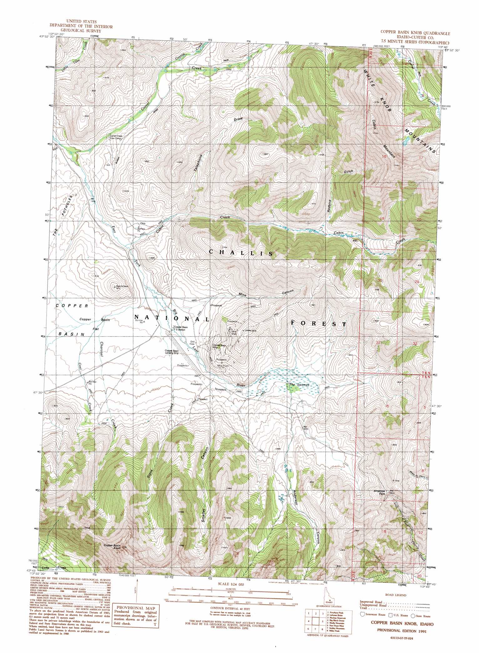
USGS Topo Quad 43113g7 - 1:24,000 scale
| Topo Map Name: | Copper Basin Knob |
| USGS Topo Quad ID: | 43113g7 |
| Print Size: | ca. 21 1/4" wide x 27" high |
| Southeast Coordinates: | 43.75° N latitude / 113.75° W longitude |
| Map Center Coordinates: | 43.8125° N latitude / 113.8125° W longitude |
| U.S. State: | ID |
| Filename: | o43113g7.jpg |
| Download Map JPG Image: | Copper Basin Knob topo map 1:24,000 scale |
| Map Type: | Topographic |
| Topo Series: | 7.5´ |
| Map Scale: | 1:24,000 |
| Source of Map Images: | United States Geological Survey (USGS) |
| Alternate Map Versions: |
Copper Basin Knob ID 1991, updated 1991 Download PDF Buy paper map Copper Basin Knob ID 2011 Download PDF Buy paper map Copper Basin Knob ID 2013 Download PDF Buy paper map |
| FStopo: | US Forest Service topo Copper Basin Knob is available: Download FStopo PDF Download FStopo TIF |
1:24,000 Topo Quads surrounding Copper Basin Knob
Jerry Peak |
Chilly Buttes |
Elkhorn Creek |
Leatherman Peak |
Massacre Mountain |
Harry Canyon |
Porphyry Peak |
Lehman Butte |
Mackay Reservoir |
Mackay |
Standhope Peak |
Big Black Dome |
Copper Basin Knob |
Shelly Mountain |
Big Blind Canyon |
Grays Peak |
Star Hope Mine |
Smiley Mountain |
Miller Peak |
Grouse |
Baugh Creek |
Muldoon |
Trail Creek |
Blizzard Mountain North |
Champagne Creek |
> Back to 43113e1 at 1:100,000 scale
> Back to 43112a1 at 1:250,000 scale
> Back to U.S. Topo Maps home
Copper Basin Knob topo map: Gazetteer
Copper Basin Knob: Airports
Copper Basin Airport elevation 2403m 7883′Copper Basin Knob: Flats
Copper Basin Flat elevation 2391m 7844′Copper Basin Knob: Gaps
Antelope Pass elevation 2714m 8904′Copper Basin Knob: Mines
Copper Basin Mine elevation 2471m 8106′Copper Basin Knob: Streams
Cabin Creek elevation 2352m 7716′Charcoal Creek elevation 2397m 7864′
Coal Creek elevation 2366m 7762′
Corral Creek elevation 2317m 7601′
Coyote Creek elevation 2400m 7874′
Steve Creek elevation 2373m 7785′
Copper Basin Knob: Summits
Cabin Mountain elevation 3404m 11167′Copper Basin Knob elevation 3266m 10715′
Lupine Mountain elevation 2895m 9498′
Copper Basin Knob: Swamps
The Swamps elevation 2449m 8034′Copper Basin Knob: Valleys
Anderson Canyon elevation 2461m 8074′Mine Canyon elevation 2377m 7798′
Redbird Gulch elevation 2495m 8185′
Smelter Canyon elevation 2413m 7916′
Telephone Draw elevation 2397m 7864′
Copper Basin Knob digital topo map on disk
Buy this Copper Basin Knob topo map showing relief, roads, GPS coordinates and other geographical features, as a high-resolution digital map file on DVD: