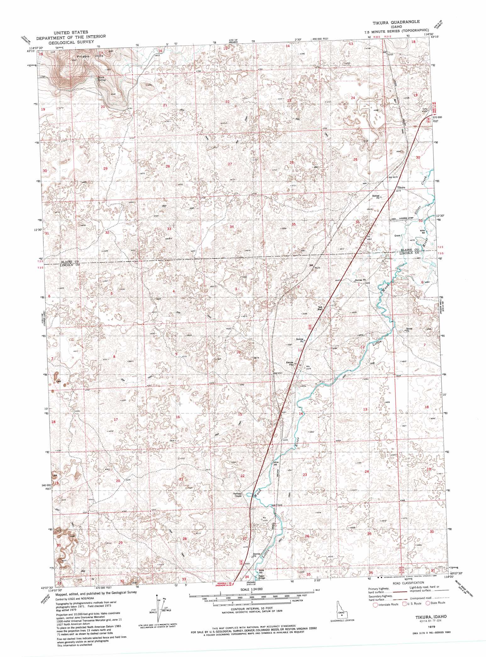
Tikura Topo Map Idaho
To zoom in, hover over the map of Tikura
USGS Topo Quad 43114b1 - 1:24,000 scale
| Topo Map Name: | Tikura |
| USGS Topo Quad ID: | 43114b1 |
| Print Size: | ca. 21 1/4" wide x 27" high |
| Southeast Coordinates: | 43.125° N latitude / 114° W longitude |
| Map Center Coordinates: | 43.1875° N latitude / 114.0625° W longitude |
| U.S. State: | ID |
| Filename: | o43114b1.jpg |
| Download Map JPG Image: | Tikura topo map 1:24,000 scale |
| Map Type: | Topographic |
| Topo Series: | 7.5´ |
| Map Scale: | 1:24,000 |
| Source of Map Images: | United States Geological Survey (USGS) |
| Alternate Map Versions: |
Tikura ID 1979, updated 1979 Download PDF Buy paper map Tikura ID 1979, updated 1986 Download PDF Buy paper map Tikura ID 2010 Download PDF Buy paper map Tikura ID 2013 Download PDF Buy paper map |
1:24,000 Topo Quads surrounding Tikura
Bellevue |
Seamans Creek |
Little Wood River Reservoir |
Lake Hills |
Fish Creek Reservoir |
Magic Reservoir East |
Gannett |
Picabo |
Carey |
Paddelford Flat |
Shoshone Ice Cave |
Tapper Lake |
Tikura |
Pagari Well |
Wagon Butte |
Kinzie Butte |
Richfield |
Pagari |
Black Ridge Crater |
Halfway Lake |
Dietrich |
Dietrich Butte |
Owinza |
Senter |
Shale Butte |
> Back to 43114a1 at 1:100,000 scale
> Back to 43114a1 at 1:250,000 scale
> Back to U.S. Topo Maps home
Tikura topo map: Gazetteer
Tikura: Bridges
Pagari Bridge elevation 1361m 4465′Tikura: Populated Places
Tikura elevation 1425m 4675′Tikura: Springs
Ditch Spring elevation 1471m 4826′Tikura: Streams
Silver Creek elevation 1416m 4645′Tikura digital topo map on disk
Buy this Tikura topo map showing relief, roads, GPS coordinates and other geographical features, as a high-resolution digital map file on DVD: