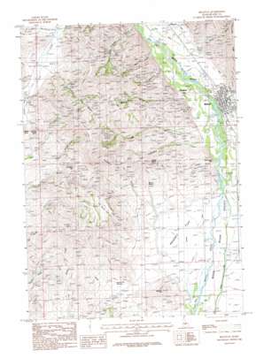
Bellevue Topo Map Idaho
To zoom in, hover over the map of Bellevue
USGS Topo Quad 43114d3 - 1:24,000 scale
| Topo Map Name: | Bellevue |
| USGS Topo Quad ID: | 43114d3 |
| Print Size: | ca. 21 1/4" wide x 27" high |
| Southeast Coordinates: | 43.375° N latitude / 114.25° W longitude |
| Map Center Coordinates: | 43.4375° N latitude / 114.3125° W longitude |
| U.S. State: | ID |
| Filename: | o43114d3.jpg |
| Download Map JPG Image: | Bellevue topo map 1:24,000 scale |
| Map Type: | Topographic |
| Topo Series: | 7.5´ |
| Map Scale: | 1:24,000 |
| Source of Map Images: | United States Geological Survey (USGS) |
| Alternate Map Versions: |
Bellevue ID 1957, updated 1973 Download PDF Buy paper map Bellevue ID 1986, updated 1986 Download PDF Buy paper map Bellevue ID 1986, updated 1986 Download PDF Buy paper map Bellevue ID 2010 Download PDF Buy paper map Bellevue ID 2013 Download PDF Buy paper map |
1:24,000 Topo Quads surrounding Bellevue
> Back to 43114a1 at 1:100,000 scale
> Back to 43114a1 at 1:250,000 scale
> Back to U.S. Topo Maps home
Bellevue topo map: Gazetteer
Bellevue: Airports
Sluder Airstrip elevation 1529m 5016′Bellevue: Canals
Bellevue Canal elevation 1568m 5144′Bypass Canal elevation 1533m 5029′
District Canal elevation 1555m 5101′
Bellevue: Flats
Poverty Flat elevation 1533m 5029′Sky Ranch Flat elevation 1861m 6105′
Bellevue: Mines
Climax Mine elevation 1830m 6003′Croesus Mine elevation 1785m 5856′
Hope Mine elevation 1792m 5879′
McCoy Mine elevation 1844m 6049′
Minnie Moore Mine elevation 1684m 5524′
Silver Star Queen elevation 1592m 5223′
Snoose Mine elevation 1772m 5813′
Bellevue: Pillars
Horse Collar Rock elevation 1578m 5177′Bellevue: Populated Places
Bellevue elevation 1575m 5167′Broadford elevation 1580m 5183′
Bellevue: Reservoirs
Poverty Flat Reservoir elevation 1572m 5157′Bellevue: Ridges
Cowcatcher Ridge elevation 1916m 6286′Bellevue: Springs
Bannon Spring elevation 1620m 5314′Bellevue: Streams
Slaughterhouse Creek elevation 1592m 5223′Bellevue: Summits
Bunker Hill elevation 1879m 6164′Gilman Butte elevation 1858m 6095′
Mabelle Hill elevation 1698m 5570′
Rattler Butte elevation 1908m 6259′
Bellevue: Valleys
Colorade Gulch elevation 1608m 5275′Croesus Gulch elevation 1669m 5475′
Diebenow Gulch elevation 1553m 5095′
Dipper Gulch elevation 1561m 5121′
Hot Spring Gulch elevation 1651m 5416′
Lees Gulch elevation 1570m 5150′
Mammoth Gulch elevation 1595m 5232′
Minnie Moore Gulch elevation 1632m 5354′
Star Gulch elevation 1595m 5232′
Townsend Gulch elevation 1565m 5134′
Water Gulch elevation 1603m 5259′
Wilson Gulch elevation 1668m 5472′
Bellevue digital topo map on disk
Buy this Bellevue topo map showing relief, roads, GPS coordinates and other geographical features, as a high-resolution digital map file on DVD:


