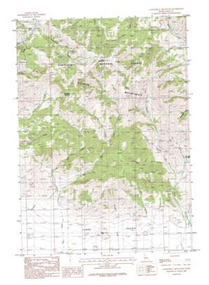
Cannonball Mountain Topo Map Idaho
To zoom in, hover over the map of Cannonball Mountain
USGS Topo Quad 43114d6 - 1:24,000 scale
| Topo Map Name: | Cannonball Mountain |
| USGS Topo Quad ID: | 43114d6 |
| Print Size: | ca. 21 1/4" wide x 27" high |
| Southeast Coordinates: | 43.375° N latitude / 114.625° W longitude |
| Map Center Coordinates: | 43.4375° N latitude / 114.6875° W longitude |
| U.S. State: | ID |
| Filename: | o43114d6.jpg |
| Download Map JPG Image: | Cannonball Mountain topo map 1:24,000 scale |
| Map Type: | Topographic |
| Topo Series: | 7.5´ |
| Map Scale: | 1:24,000 |
| Source of Map Images: | United States Geological Survey (USGS) |
| Alternate Map Versions: |
Cannonball Mountain ID 1986, updated 1986 Download PDF Buy paper map Cannonball Mountain ID 2011 Download PDF Buy paper map Cannonball Mountain ID 2013 Download PDF Buy paper map |
| FStopo: | US Forest Service topo Cannonball Mountain is available: Download FStopo PDF Download FStopo TIF |
1:24,000 Topo Quads surrounding Cannonball Mountain
> Back to 43114a1 at 1:100,000 scale
> Back to 43114a1 at 1:250,000 scale
> Back to U.S. Topo Maps home
Cannonball Mountain topo map: Gazetteer
Cannonball Mountain: Springs
Elk Creek Hot Spring elevation 1730m 5675′Cannonball Mountain: Streams
Big Deer Creek elevation 1626m 5334′Blowout Creek elevation 1712m 5616′
Buttercup Creek elevation 1762m 5780′
Cannonball Creek elevation 1999m 6558′
Chicken Creek elevation 1821m 5974′
Cookstove Creek elevation 1687m 5534′
East Fork Elk Creek elevation 1852m 6076′
Hot Spring Creek elevation 1649m 5410′
Lightning Creek elevation 1764m 5787′
Little Deer Creek elevation 1669m 5475′
Sawmill Creek elevation 2035m 6676′
West Fork Elk Creek elevation 1852m 6076′
Cannonball Mountain: Summits
Cannonball Mountain elevation 2537m 8323′Cline Hill elevation 1633m 5357′
Liberal Mountain elevation 2505m 8218′
Cannonball Mountain: Valleys
Mill Canyon elevation 1591m 5219′Wood Gulch elevation 2013m 6604′
Cannonball Mountain digital topo map on disk
Buy this Cannonball Mountain topo map showing relief, roads, GPS coordinates and other geographical features, as a high-resolution digital map file on DVD:


