Phillips Creek Topo Map Idaho
To zoom in, hover over the map of Phillips Creek
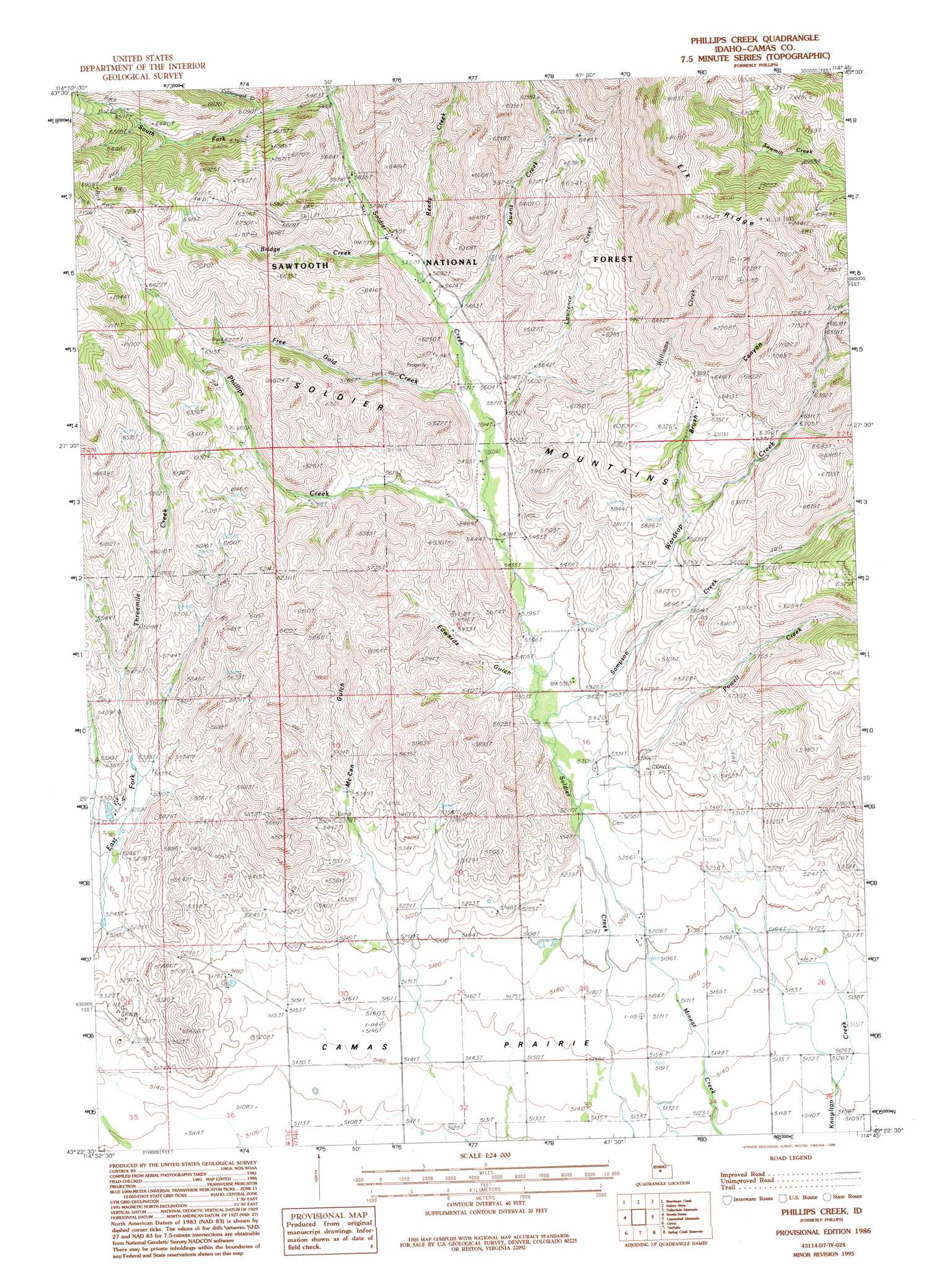
USGS Topo Quad 43114d7 - 1:24,000 scale
| Topo Map Name: | Phillips Creek |
| USGS Topo Quad ID: | 43114d7 |
| Print Size: | ca. 21 1/4" wide x 27" high |
| Southeast Coordinates: | 43.375° N latitude / 114.75° W longitude |
| Map Center Coordinates: | 43.4375° N latitude / 114.8125° W longitude |
| U.S. State: | ID |
| Filename: | o43114d7.jpg |
| Download Map JPG Image: | Phillips Creek topo map 1:24,000 scale |
| Map Type: | Topographic |
| Topo Series: | 7.5´ |
| Map Scale: | 1:24,000 |
| Source of Map Images: | United States Geological Survey (USGS) |
| Alternate Map Versions: |
Phillips ID 1986, updated 1986 Download PDF Buy paper map Phillips Creek ID 1986, updated 1996 Download PDF Buy paper map Phillips Creek ID 2011 Download PDF Buy paper map Phillips Creek ID 2013 Download PDF Buy paper map |
| FStopo: | US Forest Service topo Phillips Creek is available: Download FStopo PDF Download FStopo TIF |
1:24,000 Topo Quads surrounding Phillips Creek
Ross Peak |
Newman Peak |
Paradise Peak |
Baker Peak |
Boyle Mountain |
Jumbo Mountain |
Boardman Creek |
Sydney Butte |
Dollarhide Mountain |
Buttercup Mountain |
Deer Mountain |
Smoky Dome |
Phillips Creek |
Cannonball Mountain |
Beaver Creek |
Hill City |
Corral |
Fairfield |
Spring Creek Reservoir |
Macon |
Dempsey Meadows |
Davis Mountain |
Fir Grove Mountain |
Mchan Reservoir |
Thorn Creek Reservoir |
> Back to 43114a1 at 1:100,000 scale
> Back to 43114a1 at 1:250,000 scale
> Back to U.S. Topo Maps home
Phillips Creek topo map: Gazetteer
Phillips Creek: Areas
Soldier Mountain Ski Area elevation 1771m 5810′Phillips Creek: Mines
Richard Allen Mine elevation 1721m 5646′Phillips Creek: Ridges
Elk Ridge elevation 2364m 7755′Phillips Creek: Streams
Bridge Creek elevation 1746m 5728′Free Gold Creek elevation 1689m 5541′
Lawrence Creek elevation 1683m 5521′
North Fork Soldier Creek elevation 1813m 5948′
Owens Creek elevation 1718m 5636′
Phillips Creek elevation 1659m 5442′
Reedy Creek elevation 1731m 5679′
Sampson Creek elevation 1634m 5360′
South Fork Soldier Creek elevation 1813m 5948′
Wardrop Creek elevation 1646m 5400′
Williams Creek elevation 1712m 5616′
Phillips Creek: Summits
Wells Summit elevation 2328m 7637′Phillips Creek: Valleys
Brush Canyon elevation 1794m 5885′Edwards Gulch elevation 1635m 5364′
McCan Gulch elevation 1599m 5246′
Phillips Creek digital topo map on disk
Buy this Phillips Creek topo map showing relief, roads, GPS coordinates and other geographical features, as a high-resolution digital map file on DVD: