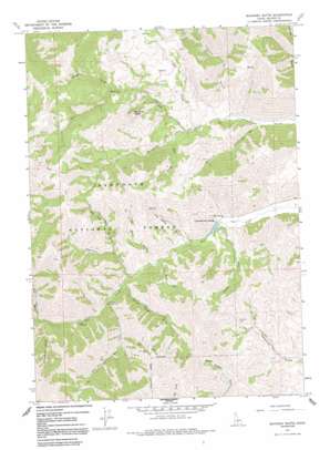
Mahoney Butte Topo Map Idaho
To zoom in, hover over the map of Mahoney Butte
USGS Topo Quad 43114e4 - 1:24,000 scale
| Topo Map Name: | Mahoney Butte |
| USGS Topo Quad ID: | 43114e4 |
| Print Size: | ca. 21 1/4" wide x 27" high |
| Southeast Coordinates: | 43.5° N latitude / 114.375° W longitude |
| Map Center Coordinates: | 43.5625° N latitude / 114.4375° W longitude |
| U.S. State: | ID |
| Filename: | o43114e4.jpg |
| Download Map JPG Image: | Mahoney Butte topo map 1:24,000 scale |
| Map Type: | Topographic |
| Topo Series: | 7.5´ |
| Map Scale: | 1:24,000 |
| Source of Map Images: | United States Geological Survey (USGS) |
| Alternate Map Versions: |
Mahoney Butte ID 1967, updated 1971 Download PDF Buy paper map Mahoney Butte ID 1967, updated 1980 Download PDF Buy paper map Mahoney Butte ID 1967, updated 1991 Download PDF Buy paper map Mahoney Butte ID 2011 Download PDF Buy paper map Mahoney Butte ID 2013 Download PDF Buy paper map |
| FStopo: | US Forest Service topo Mahoney Butte is available: Download FStopo PDF Download FStopo TIF |
1:24,000 Topo Quads surrounding Mahoney Butte
> Back to 43114e1 at 1:100,000 scale
> Back to 43114a1 at 1:250,000 scale
> Back to U.S. Topo Maps home
Mahoney Butte topo map: Gazetteer
Mahoney Butte: Dams
Clarendon Hot Springs Dam elevation 1720m 5643′Mahoney Butte: Mines
Democrat Mine elevation 1978m 6489′Red Cloud Mine elevation 2246m 7368′
Mahoney Butte: Populated Places
Clarendon Hot Springs elevation 1723m 5652′Mahoney Butte: Streams
Cow Creek elevation 1815m 5954′Jimmie Creek elevation 1718m 5636′
Mahoney Creek elevation 1825m 5987′
North Fork Deer Creek elevation 1827m 5994′
Sawmill Creek elevation 1901m 6236′
Twin Bridges Creek elevation 1767m 5797′
Wolftone Creek elevation 1812m 5944′
Mahoney Butte: Summits
Mahoney Butte elevation 2350m 7709′Mahoney Butte: Valleys
Imperial Gulch elevation 1747m 5731′Jolly Sailor Gulch elevation 1778m 5833′
Limekiln Gulch elevation 1763m 5784′
Lodgepole Gulch elevation 2076m 6811′
Narrow Gauge Gulch elevation 1768m 5800′
Nay Aug Gulch elevation 1851m 6072′
Panther Gulch elevation 1821m 5974′
Snowslide Gulch elevation 1839m 6033′
War Dance Gulch elevation 1750m 5741′
Mahoney Butte digital topo map on disk
Buy this Mahoney Butte topo map showing relief, roads, GPS coordinates and other geographical features, as a high-resolution digital map file on DVD:


