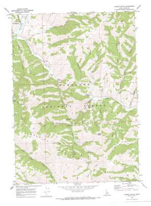
Sydney Butte Topo Map Idaho
To zoom in, hover over the map of Sydney Butte
USGS Topo Quad 43114e7 - 1:24,000 scale
| Topo Map Name: | Sydney Butte |
| USGS Topo Quad ID: | 43114e7 |
| Print Size: | ca. 21 1/4" wide x 27" high |
| Southeast Coordinates: | 43.5° N latitude / 114.75° W longitude |
| Map Center Coordinates: | 43.5625° N latitude / 114.8125° W longitude |
| U.S. State: | ID |
| Filename: | o43114e7.jpg |
| Download Map JPG Image: | Sydney Butte topo map 1:24,000 scale |
| Map Type: | Topographic |
| Topo Series: | 7.5´ |
| Map Scale: | 1:24,000 |
| Source of Map Images: | United States Geological Survey (USGS) |
| Alternate Map Versions: |
Sydney Butte ID 1970, updated 1973 Download PDF Buy paper map Sydney Butte ID 2011 Download PDF Buy paper map Sydney Butte ID 2013 Download PDF Buy paper map |
| FStopo: | US Forest Service topo Sydney Butte is available: Download FStopo PDF Download FStopo TIF |
1:24,000 Topo Quads surrounding Sydney Butte
> Back to 43114e1 at 1:100,000 scale
> Back to 43114a1 at 1:250,000 scale
> Back to U.S. Topo Maps home
Sydney Butte topo map: Gazetteer
Sydney Butte: Mines
Five Points Mine elevation 2006m 6581′Sydney Butte: Populated Places
Indian Head Rock elevation 1895m 6217′Sydney Butte: Springs
Preis Hot Spring elevation 1726m 5662′Worswick Hot Springs elevation 1846m 6056′
Sydney Butte: Streams
Belle Creek elevation 1826m 5990′Carrie Creek elevation 1851m 6072′
East Fork Worswick Creek elevation 1857m 6092′
Five Points Creek elevation 1774m 5820′
Grindstone Creek elevation 1834m 6017′
Lick Creek elevation 1679m 5508′
Little Smoky Creek elevation 1674m 5492′
Paradise Creek elevation 1686m 5531′
Placer Creek elevation 1694m 5557′
Rosetta Creek elevation 1849m 6066′
Salt Creek elevation 1673m 5488′
West Fork Grindstone Creek elevation 1886m 6187′
West Fork Salt Creek elevation 2013m 6604′
Williams Creek elevation 1826m 5990′
Worswick Creek elevation 1819m 5967′
Sydney Butte: Summits
Couch Summit elevation 2098m 6883′Sydney Butte elevation 2481m 8139′
Sydney Butte: Valleys
McHan Gulch elevation 1853m 6079′Wash Canyon elevation 1794m 5885′
Sydney Butte digital topo map on disk
Buy this Sydney Butte topo map showing relief, roads, GPS coordinates and other geographical features, as a high-resolution digital map file on DVD:


