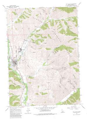
Sun Valley Topo Map Idaho
To zoom in, hover over the map of Sun Valley
USGS Topo Quad 43114f3 - 1:24,000 scale
| Topo Map Name: | Sun Valley |
| USGS Topo Quad ID: | 43114f3 |
| Print Size: | ca. 21 1/4" wide x 27" high |
| Southeast Coordinates: | 43.625° N latitude / 114.25° W longitude |
| Map Center Coordinates: | 43.6875° N latitude / 114.3125° W longitude |
| U.S. State: | ID |
| Filename: | o43114f3.jpg |
| Download Map JPG Image: | Sun Valley topo map 1:24,000 scale |
| Map Type: | Topographic |
| Topo Series: | 7.5´ |
| Map Scale: | 1:24,000 |
| Source of Map Images: | United States Geological Survey (USGS) |
| Alternate Map Versions: |
Sun Valley ID 1967, updated 1971 Download PDF Buy paper map Sun Valley ID 1967, updated 1980 Download PDF Buy paper map Sun Valley ID 1967, updated 1980 Download PDF Buy paper map Sun Valley ID 2011 Download PDF Buy paper map Sun Valley ID 2013 Download PDF Buy paper map |
| FStopo: | US Forest Service topo Sun Valley is available: Download FStopo PDF Download FStopo TIF |
1:24,000 Topo Quads surrounding Sun Valley
> Back to 43114e1 at 1:100,000 scale
> Back to 43114a1 at 1:250,000 scale
> Back to U.S. Topo Maps home
Sun Valley topo map: Gazetteer
Sun Valley: Dams
Trail Creek Dam elevation 1795m 5889′Sun Valley: Mines
Amicus Mine elevation 1996m 6548′Courier Mine elevation 1961m 6433′
Independence Mine elevation 2277m 7470′
June Day Mine elevation 1932m 6338′
Montgomery Mine elevation 2071m 6794′
North Star Mine elevation 2083m 6833′
Old Triumph Mine elevation 2159m 7083′
Parker Mine elevation 2120m 6955′
Pierce Tunnel elevation 2182m 7158′
Saint Louis Mine elevation 2084m 6837′
Triumph Mine elevation 1874m 6148′
Sun Valley: Populated Places
Elkhorn Village elevation 1824m 5984′Ketchum elevation 1784m 5853′
Sun Valley elevation 1812m 5944′
Triumph elevation 1863m 6112′
Sun Valley: Ridges
Morgan Ridge elevation 2560m 8398′Sun Valley: Streams
Antelope Creek elevation 1884m 6181′Clear Creek elevation 1729m 5672′
Corral Creek elevation 1885m 6184′
Hyndman Creek elevation 1855m 6085′
Trail Creek elevation 1745m 5725′
Sun Valley: Summits
Dollar Mountain elevation 1984m 6509′Penny Mountain elevation 1842m 6043′
Proctor Mountain elevation 2354m 7723′
Prospect Hill elevation 2029m 6656′
Ruud Mountain elevation 2041m 6696′
Sun Valley: Valleys
Badger Canyon elevation 1877m 6158′Cold Spring Gulch elevation 1738m 5702′
Courier Gulch elevation 1894m 6213′
Decker Gulch elevation 1825m 5987′
Elkhorn Gulch elevation 1772m 5813′
Independence Gulch elevation 1823m 5980′
Keystone Gulch elevation 1823m 5980′
North Star Gulch elevation 1869m 6131′
Parker Gulch elevation 1822m 5977′
Peters Gulch elevation 1787m 5862′
Pumphrey Canyon elevation 1901m 6236′
Taylor Canyon elevation 1885m 6184′
Triumph Gulch elevation 1836m 6023′
Uncle Johns Gulch elevation 1970m 6463′
Sun Valley digital topo map on disk
Buy this Sun Valley topo map showing relief, roads, GPS coordinates and other geographical features, as a high-resolution digital map file on DVD:


