Rock Roll Canyon Topo Map Idaho
To zoom in, hover over the map of Rock Roll Canyon
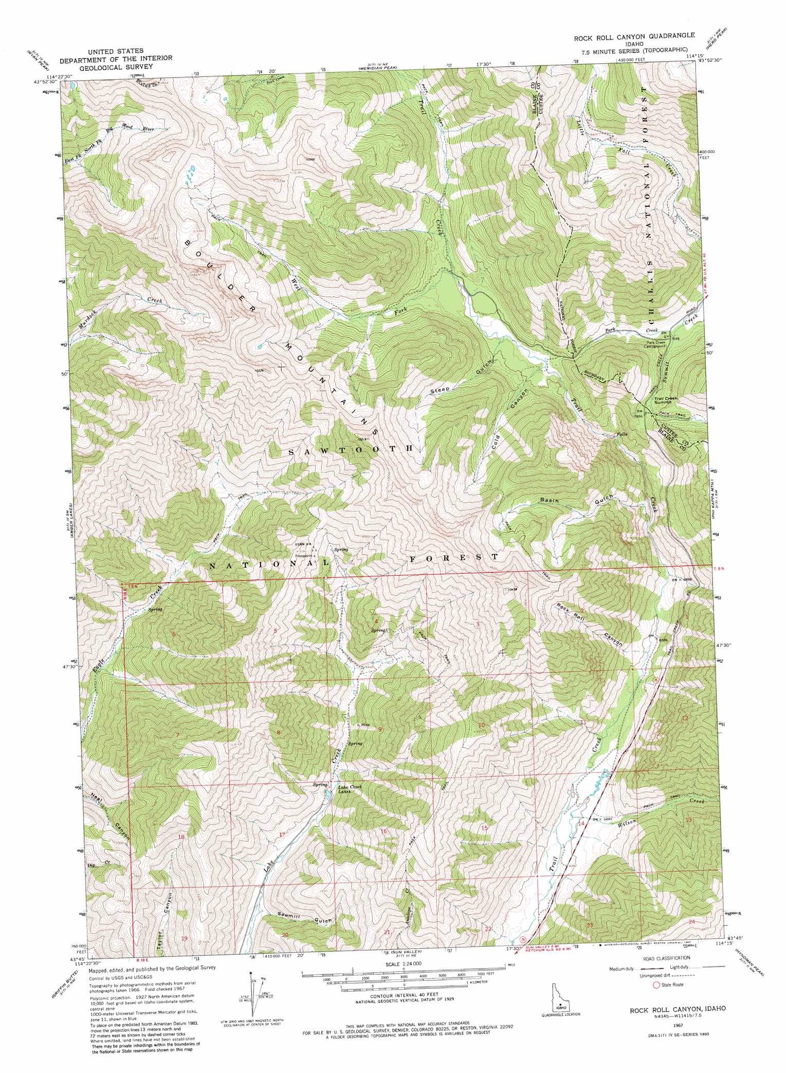
USGS Topo Quad 43114g3 - 1:24,000 scale
| Topo Map Name: | Rock Roll Canyon |
| USGS Topo Quad ID: | 43114g3 |
| Print Size: | ca. 21 1/4" wide x 27" high |
| Southeast Coordinates: | 43.75° N latitude / 114.25° W longitude |
| Map Center Coordinates: | 43.8125° N latitude / 114.3125° W longitude |
| U.S. State: | ID |
| Filename: | o43114g3.jpg |
| Download Map JPG Image: | Rock Roll Canyon topo map 1:24,000 scale |
| Map Type: | Topographic |
| Topo Series: | 7.5´ |
| Map Scale: | 1:24,000 |
| Source of Map Images: | United States Geological Survey (USGS) |
| Alternate Map Versions: |
Rock Roll Canyon ID 1967, updated 1971 Download PDF Buy paper map Rock Roll Canyon ID 1967, updated 1982 Download PDF Buy paper map Rock Roll Canyon ID 2011 Download PDF Buy paper map Rock Roll Canyon ID 2013 Download PDF Buy paper map |
| FStopo: | US Forest Service topo Rock Roll Canyon is available: Download FStopo PDF Download FStopo TIF |
1:24,000 Topo Quads surrounding Rock Roll Canyon
Boulder Chain Lakes |
Bowery Creek |
Bowery Peak |
Herd Lake |
Jerry Peak |
Galena Peak |
Ryan Peak |
Meridian Peak |
Herd Peak |
Harry Canyon |
Easley Hot Springs |
Amber Lakes |
Rock Roll Canyon |
Phi Kappa Mountain |
Standhope Peak |
Boyle Mountain |
Griffin Butte |
Sun Valley |
Hyndman Peak |
Grays Peak |
Buttercup Mountain |
Mahoney Butte |
Hailey |
Baugh Creek Sw |
Baugh Creek |
> Back to 43114e1 at 1:100,000 scale
> Back to 43114a1 at 1:250,000 scale
> Back to U.S. Topo Maps home
Rock Roll Canyon topo map: Gazetteer
Rock Roll Canyon: Lakes
Lake Creek Lakes elevation 2016m 6614′Rock Roll Canyon: Streams
Park Creek elevation 2329m 7641′West Fork Trail Creek elevation 2385m 7824′
Wilson Creek elevation 1938m 6358′
Rock Roll Canyon: Summits
Trail Creek Summit elevation 2402m 7880′Rock Roll Canyon: Valleys
Basin Gulch elevation 2108m 6916′Cold Canyon elevation 2377m 7798′
Rock Roll Canyon elevation 2014m 6607′
Sawmill Gulch elevation 1938m 6358′
Steep Gulch elevation 2373m 7785′
Rock Roll Canyon digital topo map on disk
Buy this Rock Roll Canyon topo map showing relief, roads, GPS coordinates and other geographical features, as a high-resolution digital map file on DVD: