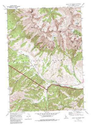
Easley Hot Springs Topo Map Idaho
To zoom in, hover over the map of Easley Hot Springs
USGS Topo Quad 43114g5 - 1:24,000 scale
| Topo Map Name: | Easley Hot Springs |
| USGS Topo Quad ID: | 43114g5 |
| Print Size: | ca. 21 1/4" wide x 27" high |
| Southeast Coordinates: | 43.75° N latitude / 114.5° W longitude |
| Map Center Coordinates: | 43.8125° N latitude / 114.5625° W longitude |
| U.S. State: | ID |
| Filename: | o43114g5.jpg |
| Download Map JPG Image: | Easley Hot Springs topo map 1:24,000 scale |
| Map Type: | Topographic |
| Topo Series: | 7.5´ |
| Map Scale: | 1:24,000 |
| Source of Map Images: | United States Geological Survey (USGS) |
| Alternate Map Versions: |
Easley Hot Springs ID 1970, updated 1973 Download PDF Buy paper map Easley Hot Springs ID 1970, updated 1985 Download PDF Buy paper map Easley Hot Springs ID 1970, updated 1985 Download PDF Buy paper map Easley Hot Springs ID 2011 Download PDF Buy paper map Easley Hot Springs ID 2013 Download PDF Buy paper map |
| FStopo: | US Forest Service topo Easley Hot Springs is available: Download FStopo PDF Download FStopo TIF |
1:24,000 Topo Quads surrounding Easley Hot Springs
> Back to 43114e1 at 1:100,000 scale
> Back to 43114a1 at 1:250,000 scale
> Back to U.S. Topo Maps home
Easley Hot Springs topo map: Gazetteer
Easley Hot Springs: Basins
Boulder Basin elevation 2839m 9314′Easley Hot Springs: Cliffs
Crown Point elevation 2966m 9730′Easley Hot Springs: Lakes
Boulder Lakes elevation 2900m 9514′Silver Lake elevation 2947m 9668′
Window Lake elevation 3055m 10022′
Easley Hot Springs: Parks
Baker Creek Picnic Area elevation 2025m 6643′Easley Hot Springs: Populated Places
Boulder elevation 2790m 9153′Cathedral Pines elevation 2001m 6564′
Easley Hot Springs elevation 2027m 6650′
Easley Hot Springs: Streams
Anderson Creek elevation 2067m 6781′Baker Creek elevation 2025m 6643′
Butterfield Creek elevation 2050m 6725′
Dooley Creek elevation 2068m 6784′
Easley Creek elevation 2008m 6587′
Newman Creek elevation 2071m 6794′
Prairie Creek elevation 2095m 6873′
Silver Creek elevation 2039m 6689′
Snow Creek elevation 2031m 6663′
Spruce Creek elevation 2054m 6738′
Easley Hot Springs: Summits
Boulder Peak elevation 3334m 10938′Easley Peak elevation 3375m 11072′
Silver Peak elevation 3342m 10964′
Easley Hot Springs: Valleys
Buccal Gulch elevation 2068m 6784′Easley Gulch elevation 2026m 6646′
Logged Canyon elevation 2050m 6725′
Quadrant Gulch elevation 2095m 6873′
Easley Hot Springs digital topo map on disk
Buy this Easley Hot Springs topo map showing relief, roads, GPS coordinates and other geographical features, as a high-resolution digital map file on DVD:


