Reverse Topo Map Idaho
To zoom in, hover over the map of Reverse
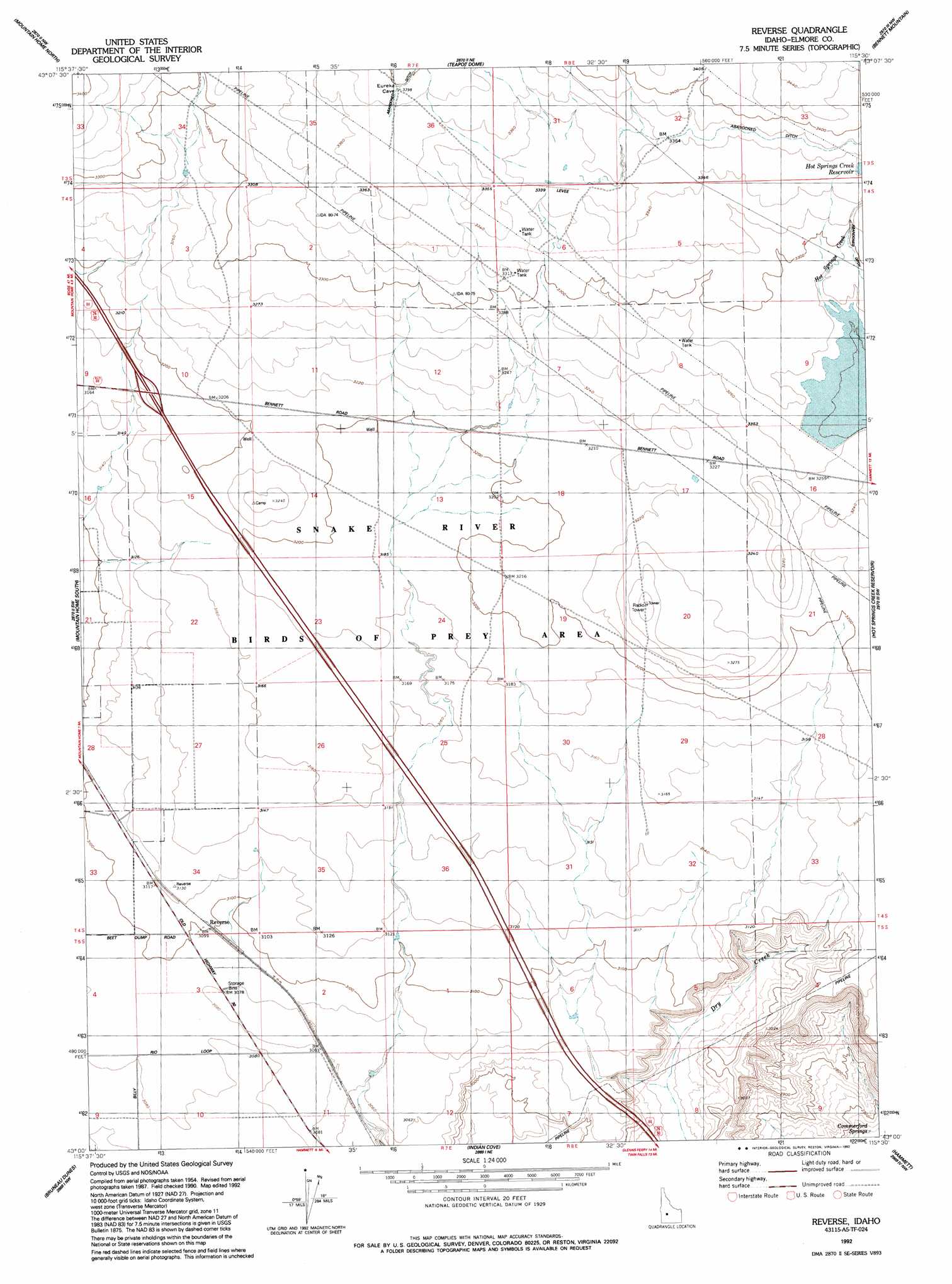
USGS Topo Quad 43115a5 - 1:24,000 scale
| Topo Map Name: | Reverse |
| USGS Topo Quad ID: | 43115a5 |
| Print Size: | ca. 21 1/4" wide x 27" high |
| Southeast Coordinates: | 43° N latitude / 115.5° W longitude |
| Map Center Coordinates: | 43.0625° N latitude / 115.5625° W longitude |
| U.S. State: | ID |
| Filename: | o43115a5.jpg |
| Download Map JPG Image: | Reverse topo map 1:24,000 scale |
| Map Type: | Topographic |
| Topo Series: | 7.5´ |
| Map Scale: | 1:24,000 |
| Source of Map Images: | United States Geological Survey (USGS) |
| Alternate Map Versions: |
Reverse ID 1956, updated 1957 Download PDF Buy paper map Reverse ID 1956, updated 1976 Download PDF Buy paper map Reverse ID 1956, updated 1978 Download PDF Buy paper map Reverse ID 1992, updated 1992 Download PDF Buy paper map Reverse ID 2011 Download PDF Buy paper map Reverse ID 2013 Download PDF Buy paper map |
1:24,000 Topo Quads surrounding Reverse
Mayfield Se |
Syrup Creek |
Long Tom Reservoir |
Anderson Ranch Dam |
Cat Creek Summit |
Crater Rings |
Mountain Home North |
Teapot Dome |
Bennett Mountain |
Goodman Flat |
Crater Rings Se |
Mountain Home South |
Reverse |
Hot Springs Creek Reservoir |
Morrow Reservoir |
Bruneau |
Bruneau Dunes |
Indian Cove |
Hammett |
Glenns Ferry |
Sugar Valley |
Hot Spring |
Pence Butte |
Pot Hole Canyon |
Grindstone Butte |
> Back to 43115a1 at 1:100,000 scale
> Back to 43114a1 at 1:250,000 scale
> Back to U.S. Topo Maps home
Reverse topo map: Gazetteer
Reverse: Dams
Hall Dam elevation 1022m 3353′Reverse: Populated Places
Reverse elevation 946m 3103′Reverse: Reservoirs
Hot Springs Creek Reservoir elevation 1022m 3353′Reverse digital topo map on disk
Buy this Reverse topo map showing relief, roads, GPS coordinates and other geographical features, as a high-resolution digital map file on DVD: