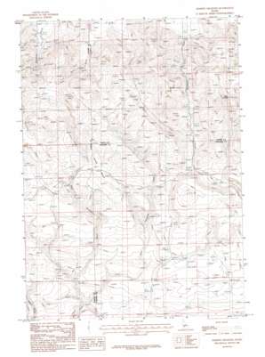
Dempsey Meadows Topo Map Idaho
To zoom in, hover over the map of Dempsey Meadows
USGS Topo Quad 43115b1 - 1:24,000 scale
| Topo Map Name: | Dempsey Meadows |
| USGS Topo Quad ID: | 43115b1 |
| Print Size: | ca. 21 1/4" wide x 27" high |
| Southeast Coordinates: | 43.125° N latitude / 115° W longitude |
| Map Center Coordinates: | 43.1875° N latitude / 115.0625° W longitude |
| U.S. State: | ID |
| Filename: | o43115b1.jpg |
| Download Map JPG Image: | Dempsey Meadows topo map 1:24,000 scale |
| Map Type: | Topographic |
| Topo Series: | 7.5´ |
| Map Scale: | 1:24,000 |
| Source of Map Images: | United States Geological Survey (USGS) |
| Alternate Map Versions: |
Dempsey Meadows ID 1986, updated 1986 Download PDF Buy paper map Dempsey Meadows ID 2010 Download PDF Buy paper map Dempsey Meadows ID 2013 Download PDF Buy paper map |
1:24,000 Topo Quads surrounding Dempsey Meadows
> Back to 43115a1 at 1:100,000 scale
> Back to 43114a1 at 1:250,000 scale
> Back to U.S. Topo Maps home
Dempsey Meadows topo map: Gazetteer
Dempsey Meadows: Flats
Dead Horse Flat elevation 1669m 5475′Dempsey Meadows elevation 1669m 5475′
Dempsey Meadows: Ranges
Mount Bennnett Hills elevation 1860m 6102′Dempsey Meadows: Springs
Indian Writing Water Hole elevation 1666m 5465′Tub Spring elevation 1537m 5042′
Dempsey Meadows: Streams
East Dempsey Creek elevation 1423m 4668′West Dempsey Creek elevation 1423m 4668′
Dempsey Meadows: Summits
The Knob elevation 1992m 6535′The Knob elevation 2002m 6568′
Dempsey Meadows digital topo map on disk
Buy this Dempsey Meadows topo map showing relief, roads, GPS coordinates and other geographical features, as a high-resolution digital map file on DVD:


