Crater Rings Topo Map Idaho
To zoom in, hover over the map of Crater Rings
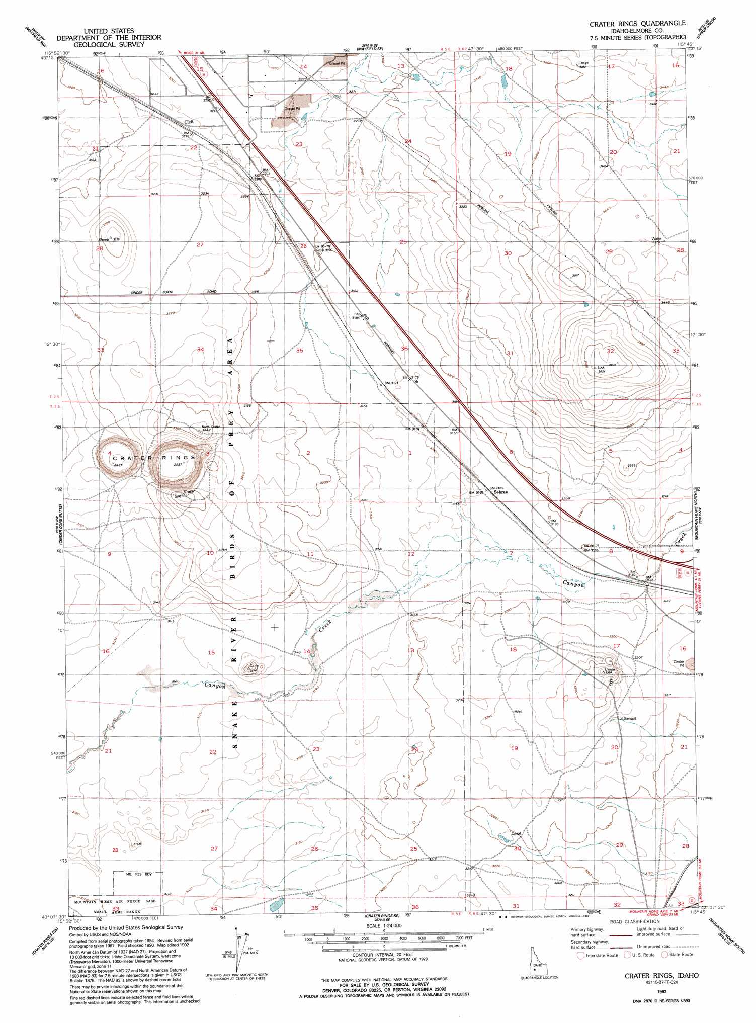
USGS Topo Quad 43115b7 - 1:24,000 scale
| Topo Map Name: | Crater Rings |
| USGS Topo Quad ID: | 43115b7 |
| Print Size: | ca. 21 1/4" wide x 27" high |
| Southeast Coordinates: | 43.125° N latitude / 115.75° W longitude |
| Map Center Coordinates: | 43.1875° N latitude / 115.8125° W longitude |
| U.S. State: | ID |
| Filename: | o43115b7.jpg |
| Download Map JPG Image: | Crater Rings topo map 1:24,000 scale |
| Map Type: | Topographic |
| Topo Series: | 7.5´ |
| Map Scale: | 1:24,000 |
| Source of Map Images: | United States Geological Survey (USGS) |
| Alternate Map Versions: |
Crater Rings ID 1956, updated 1957 Download PDF Buy paper map Crater Rings ID 1956, updated 1973 Download PDF Buy paper map Crater Rings ID 1956, updated 1979 Download PDF Buy paper map Crater Rings ID 1992, updated 1992 Download PDF Buy paper map Crater Rings ID 2010 Download PDF Buy paper map Crater Rings ID 2013 Download PDF Buy paper map |
1:24,000 Topo Quads surrounding Crater Rings
Indian Creek Reservoir |
Mayfield |
Braves Creek |
Danskin Peak |
Cathedral Rocks |
Orchard |
Mayfield Sw |
Mayfield Se |
Syrup Creek |
Long Tom Reservoir |
Little Joe Butte |
Cinder Cone Butte |
Crater Rings |
Mountain Home North |
Teapot Dome |
Dorsey Butte |
Crater Rings Sw |
Crater Rings Se |
Mountain Home South |
Reverse |
Grand View |
C J Strike Dam |
Bruneau |
Bruneau Dunes |
Indian Cove |
> Back to 43115a1 at 1:100,000 scale
> Back to 43114a1 at 1:250,000 scale
> Back to U.S. Topo Maps home
Crater Rings topo map: Gazetteer
Crater Rings: Canals
Old Lamberton Canal (historical) elevation 968m 3175′Crater Rings: Craters
Crater Rings elevation 899m 2949′Crater Rings: Populated Places
Cleft elevation 983m 3225′Sebree elevation 964m 3162′
Crater Rings digital topo map on disk
Buy this Crater Rings topo map showing relief, roads, GPS coordinates and other geographical features, as a high-resolution digital map file on DVD: