Braves Creek Topo Map Idaho
To zoom in, hover over the map of Braves Creek
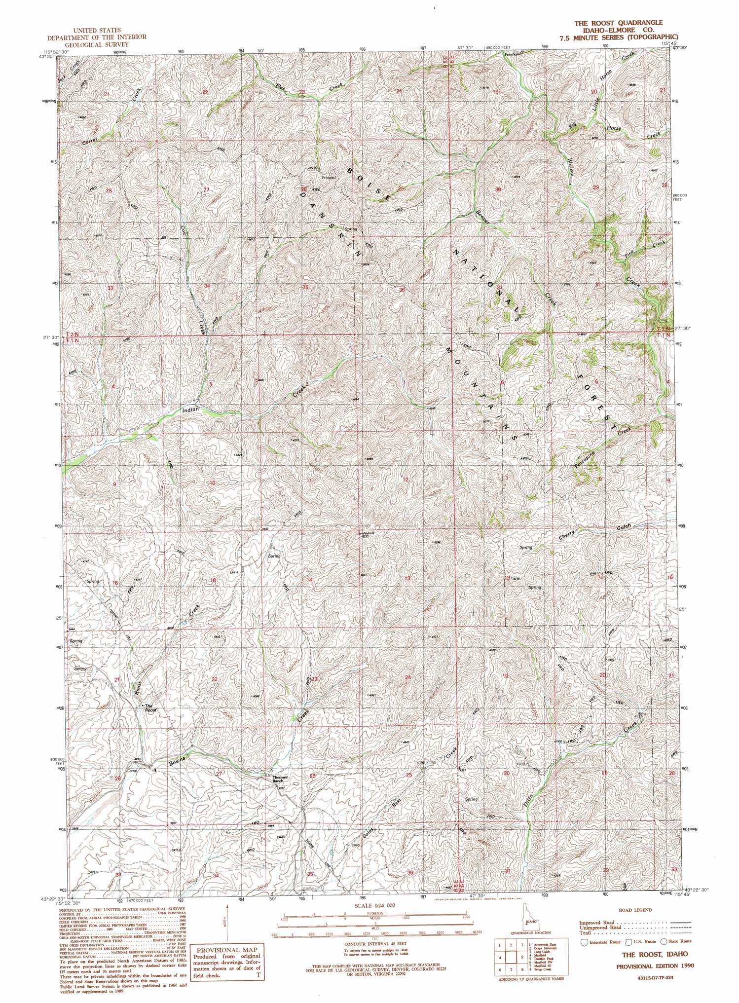
USGS Topo Quad 43115d7 - 1:24,000 scale
| Topo Map Name: | Braves Creek |
| USGS Topo Quad ID: | 43115d7 |
| Print Size: | ca. 21 1/4" wide x 27" high |
| Southeast Coordinates: | 43.375° N latitude / 115.75° W longitude |
| Map Center Coordinates: | 43.4375° N latitude / 115.8125° W longitude |
| U.S. State: | ID |
| Filename: | o43115d7.jpg |
| Download Map JPG Image: | Braves Creek topo map 1:24,000 scale |
| Map Type: | Topographic |
| Topo Series: | 7.5´ |
| Map Scale: | 1:24,000 |
| Source of Map Images: | United States Geological Survey (USGS) |
| Alternate Map Versions: |
The Roost ID 1990, updated 1991 Download PDF Buy paper map The Roost ID 2011 Download PDF Buy paper map The Roost ID 2013 Download PDF Buy paper map |
| FStopo: | US Forest Service topo The Roost is available: Download FStopo PDF Download FStopo TIF |
1:24,000 Topo Quads surrounding Braves Creek
Robie Creek |
Dunnigan Creek |
Arrowrock Reservoir Ne |
Twin Springs |
Sheep Creek |
Lucky Peak |
Arrowrock Dam |
Grape Mountain |
Long Gulch |
Prairie |
Indian Creek Reservoir |
Mayfield |
Braves Creek |
Danskin Peak |
Cathedral Rocks |
Orchard |
Mayfield Sw |
Mayfield Se |
Syrup Creek |
Long Tom Reservoir |
Little Joe Butte |
Cinder Cone Butte |
Crater Rings |
Mountain Home North |
Teapot Dome |
> Back to 43115a1 at 1:100,000 scale
> Back to 43114a1 at 1:250,000 scale
> Back to U.S. Topo Maps home
Braves Creek topo map: Gazetteer
Braves Creek: Streams
Beaver Creek elevation 1120m 3674′Big Horse Creek elevation 1144m 3753′
Cottonwood Creek elevation 1211m 3973′
Cow Creek elevation 1170m 3838′
Fornham Creek elevation 1111m 3645′
Little Horse Creek elevation 1197m 3927′
Pine Creek elevation 1183m 3881′
Porcupine Creek elevation 1260m 4133′
Roost Creek elevation 1097m 3599′
Braves Creek digital topo map on disk
Buy this Braves Creek topo map showing relief, roads, GPS coordinates and other geographical features, as a high-resolution digital map file on DVD: