Grouse Butte Topo Map Idaho
To zoom in, hover over the map of Grouse Butte
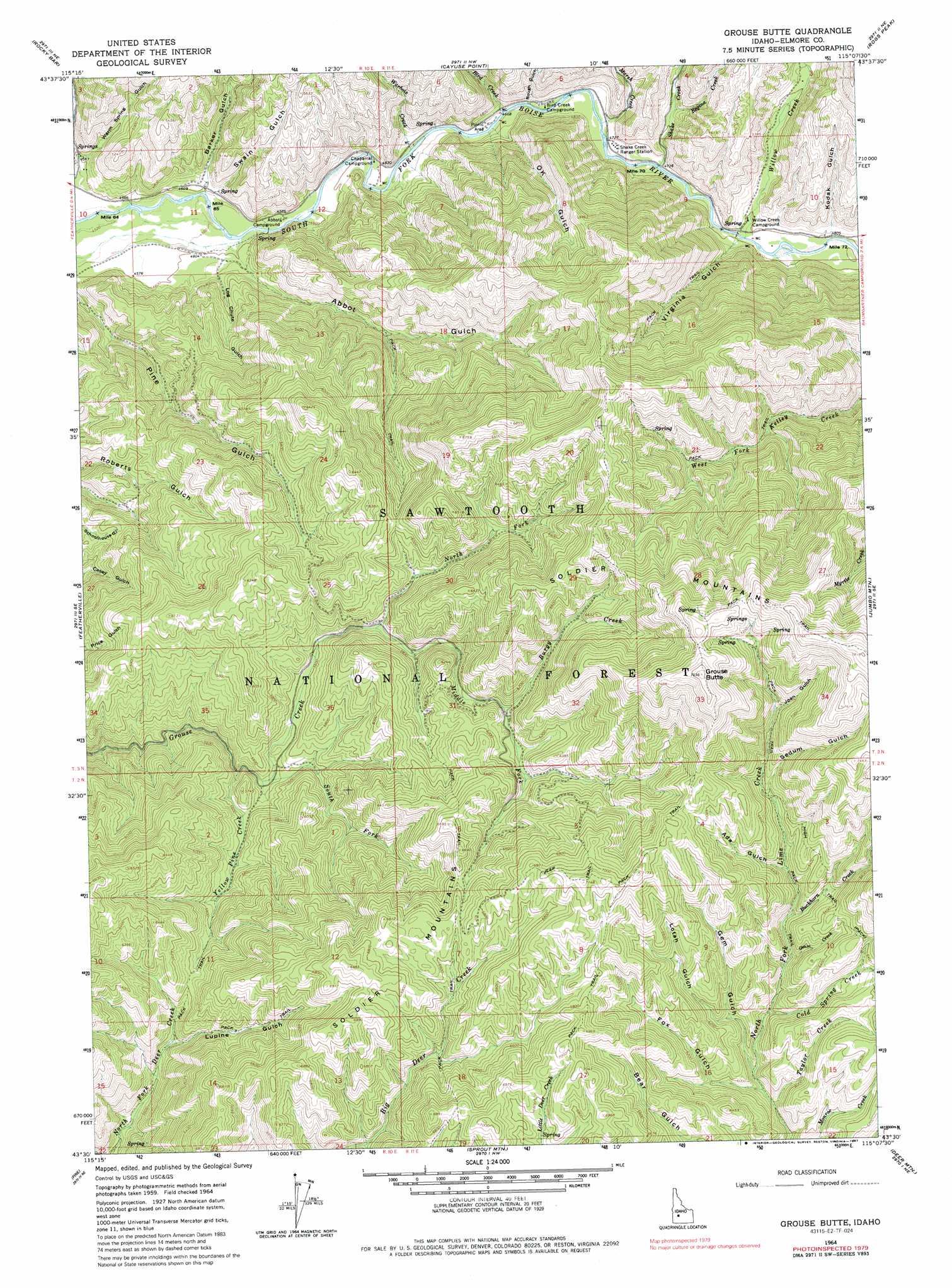
USGS Topo Quad 43115e2 - 1:24,000 scale
| Topo Map Name: | Grouse Butte |
| USGS Topo Quad ID: | 43115e2 |
| Print Size: | ca. 21 1/4" wide x 27" high |
| Southeast Coordinates: | 43.5° N latitude / 115.125° W longitude |
| Map Center Coordinates: | 43.5625° N latitude / 115.1875° W longitude |
| U.S. State: | ID |
| Filename: | o43115e2.jpg |
| Download Map JPG Image: | Grouse Butte topo map 1:24,000 scale |
| Map Type: | Topographic |
| Topo Series: | 7.5´ |
| Map Scale: | 1:24,000 |
| Source of Map Images: | United States Geological Survey (USGS) |
| Alternate Map Versions: |
Grouse Butte ID 1964, updated 1966 Download PDF Buy paper map Grouse Butte ID 1964, updated 1987 Download PDF Buy paper map Grouse Butte ID 2011 Download PDF Buy paper map Grouse Butte ID 2013 Download PDF Buy paper map |
| FStopo: | US Forest Service topo Grouse Butte is available: Download FStopo PDF Download FStopo TIF |
1:24,000 Topo Quads surrounding Grouse Butte
Grand Mountain |
Phifer Creek |
Atlanta West |
Atlanta East |
Marshall Peak |
Little Trinity Lake |
Rocky Bar |
Cayuse Point |
Ross Peak |
Newman Peak |
Trinity Mountain |
Featherville |
Grouse Butte |
Jumbo Mountain |
Boardman Creek |
House Mountain |
Pine |
Sprout Mountain |
Deer Mountain |
Smoky Dome |
Anderson Ranch Dam |
Cat Creek Summit |
High Prairie |
Hill City |
Corral |
> Back to 43115e1 at 1:100,000 scale
> Back to 43114a1 at 1:250,000 scale
> Back to U.S. Topo Maps home
Grouse Butte topo map: Gazetteer
Grouse Butte: Ranges
Soldier Mountains elevation 2116m 6942′Grouse Butte: Streams
Bird Creek elevation 1423m 4668′Buckhorn Creek elevation 1866m 6122′
Burgy Creek elevation 1830m 6003′
Cold Spring Creek elevation 1816m 5958′
Geum Creek elevation 1842m 6043′
Marsh Creek elevation 1433m 4701′
Middle Fork Grouse Creek elevation 1738m 5702′
North Fork Grouse Creek elevation 1738m 5702′
Regina Creek elevation 1472m 4829′
Shake Creek elevation 1442m 4730′
South Fork Grouse Creek elevation 1667m 5469′
Taylor Creek elevation 1781m 5843′
Warbois Creek elevation 1414m 4639′
Willow Creek elevation 1456m 4776′
Yellow Pine Creek elevation 1653m 5423′
Grouse Butte: Summits
Grouse Butte elevation 2336m 7664′Grouse Butte: Valleys
Abbot Gulch elevation 1392m 4566′Ada Gulch elevation 1930m 6332′
Barker Gulch elevation 1394m 4573′
Fox Gulch elevation 1791m 5875′
Gem Gulch elevation 1791m 5875′
Joan Gulch elevation 2038m 6686′
Kodak Gulch elevation 1484m 4868′
Log Chute Gulch elevation 1427m 4681′
Lotah Gulch elevation 1845m 6053′
Lupine Gulch elevation 1743m 5718′
Ok Gulch elevation 1427m 4681′
Rough Gulch elevation 1442m 4730′
Sedum Gulch elevation 1946m 6384′
Swain Gulch elevation 1401m 4596′
Virginia Gulch elevation 1473m 4832′
Warm Spring Gulch elevation 1402m 4599′
Grouse Butte digital topo map on disk
Buy this Grouse Butte topo map showing relief, roads, GPS coordinates and other geographical features, as a high-resolution digital map file on DVD: