Grape Mountain Topo Map Idaho
To zoom in, hover over the map of Grape Mountain
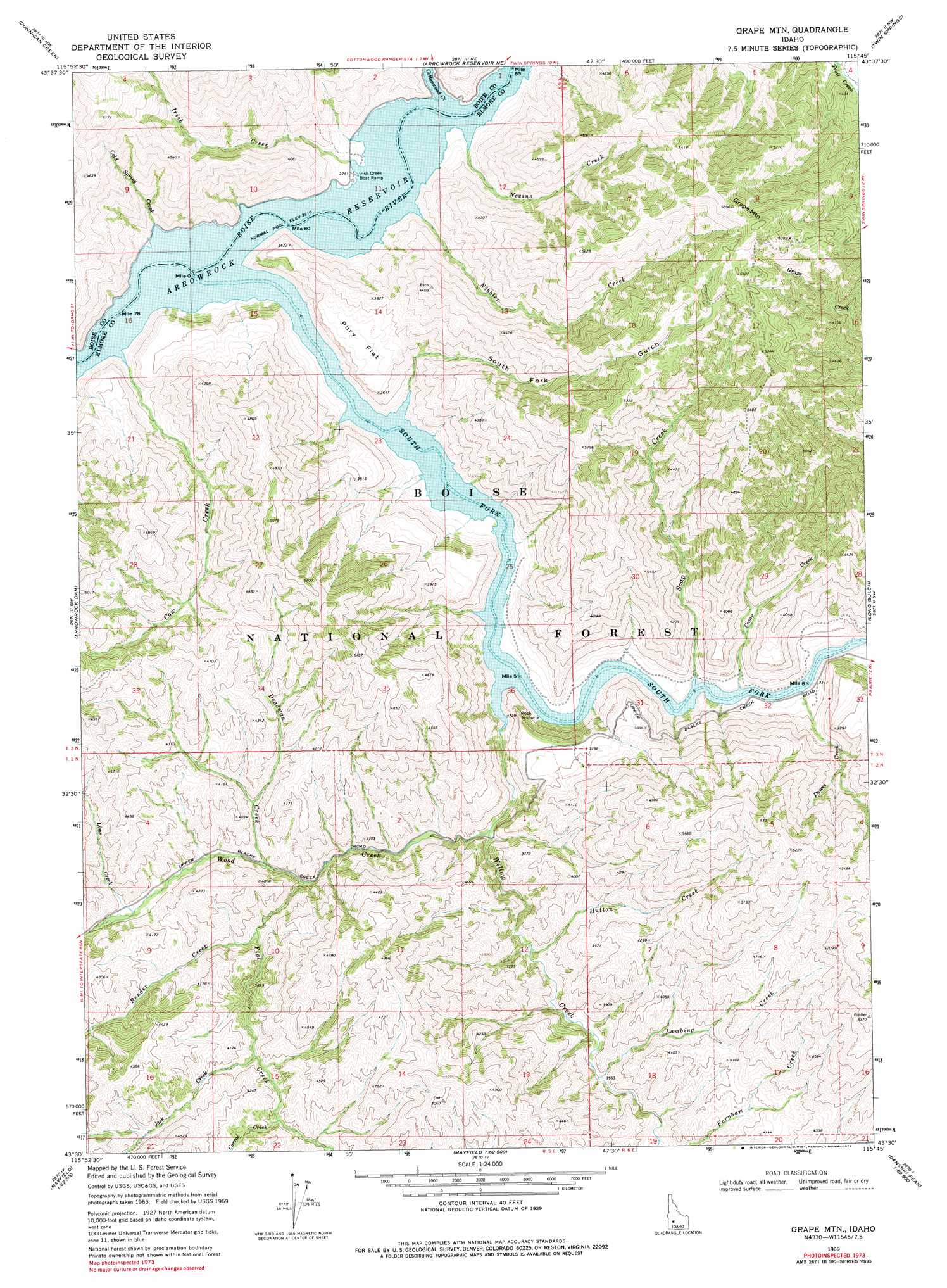
USGS Topo Quad 43115e7 - 1:24,000 scale
| Topo Map Name: | Grape Mountain |
| USGS Topo Quad ID: | 43115e7 |
| Print Size: | ca. 21 1/4" wide x 27" high |
| Southeast Coordinates: | 43.5° N latitude / 115.75° W longitude |
| Map Center Coordinates: | 43.5625° N latitude / 115.8125° W longitude |
| U.S. State: | ID |
| Filename: | o43115e7.jpg |
| Download Map JPG Image: | Grape Mountain topo map 1:24,000 scale |
| Map Type: | Topographic |
| Topo Series: | 7.5´ |
| Map Scale: | 1:24,000 |
| Source of Map Images: | United States Geological Survey (USGS) |
| Alternate Map Versions: |
Grape Mtn ID 1969, updated 1971 Download PDF Buy paper map Grape Mtn ID 1969, updated 1977 Download PDF Buy paper map Grape Mountain ID 2011 Download PDF Buy paper map Grape Mountain ID 2013 Download PDF Buy paper map |
| FStopo: | US Forest Service topo Grape Mountain is available: Download FStopo PDF Download FStopo TIF |
1:24,000 Topo Quads surrounding Grape Mountain
Shafer Butte |
Warm Springs Point |
Idaho City |
Rabbit Creek Summit |
Barber Flat |
Robie Creek |
Dunnigan Creek |
Arrowrock Reservoir Ne |
Twin Springs |
Sheep Creek |
Lucky Peak |
Arrowrock Dam |
Grape Mountain |
Long Gulch |
Prairie |
Indian Creek Reservoir |
Mayfield |
Braves Creek |
Danskin Peak |
Cathedral Rocks |
Orchard |
Mayfield Sw |
Mayfield Se |
Syrup Creek |
Long Tom Reservoir |
> Back to 43115e1 at 1:100,000 scale
> Back to 43114a1 at 1:250,000 scale
> Back to U.S. Topo Maps home
Grape Mountain topo map: Gazetteer
Grape Mountain: Flats
Pury Flat elevation 1120m 3674′Grape Mountain: Streams
Bender Creek elevation 1101m 3612′Camp Creek elevation 982m 3221′
Cold Spring Creek elevation 984m 3228′
Corral Creek elevation 1202m 3943′
Cottonwood Creek elevation 981m 3218′
Cow Creek elevation 984m 3228′
Dawes Creek elevation 1002m 3287′
Deadman Creek elevation 1088m 3569′
Flat Creek elevation 1080m 3543′
Hutton Creek elevation 1061m 3480′
Irish Creek elevation 986m 3234′
Jack Creek elevation 1181m 3874′
Lambing Creek elevation 1083m 3553′
Lime Creek elevation 1146m 3759′
Nevins Creek elevation 982m 3221′
Nibbler Creek elevation 983m 3225′
Soap Creek elevation 988m 3241′
South Fork Boise River elevation 981m 3218′
Willow Creek elevation 1019m 3343′
Wood Creek elevation 983m 3225′
Grape Mountain: Summits
Grape Mountain elevation 1794m 5885′Grape Mountain: Valleys
South Fork Gulch elevation 987m 3238′Grape Mountain digital topo map on disk
Buy this Grape Mountain topo map showing relief, roads, GPS coordinates and other geographical features, as a high-resolution digital map file on DVD: