Dunnigan Creek Topo Map Idaho
To zoom in, hover over the map of Dunnigan Creek
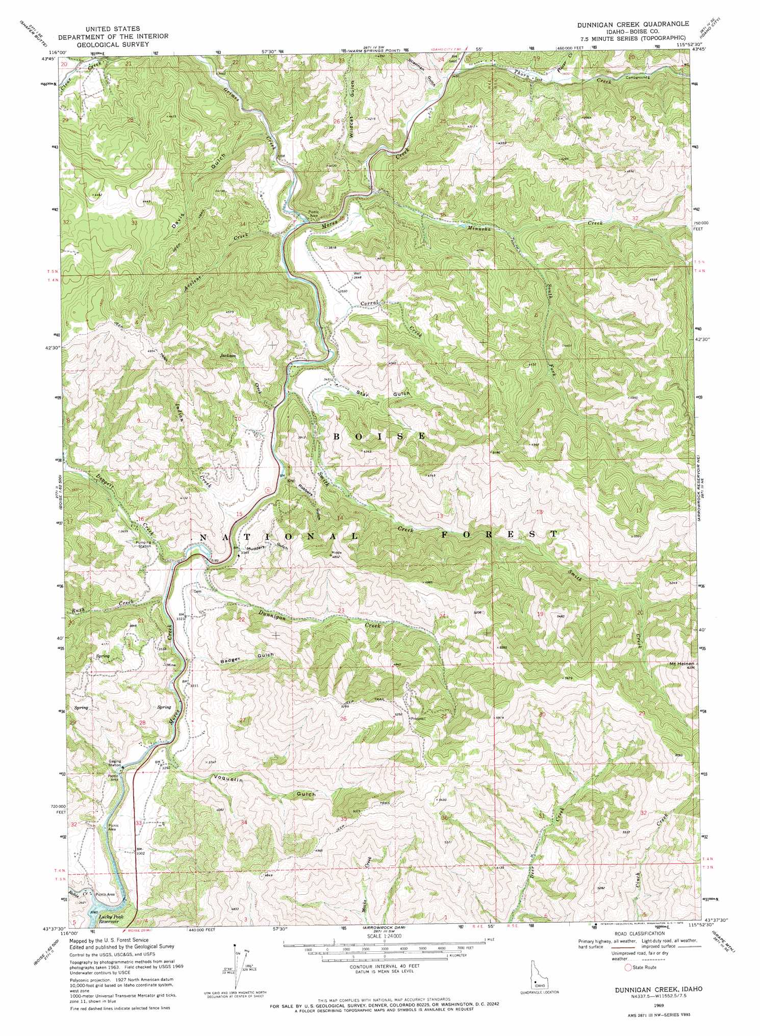
USGS Topo Quad 43115f8 - 1:24,000 scale
| Topo Map Name: | Dunnigan Creek |
| USGS Topo Quad ID: | 43115f8 |
| Print Size: | ca. 21 1/4" wide x 27" high |
| Southeast Coordinates: | 43.625° N latitude / 115.875° W longitude |
| Map Center Coordinates: | 43.6875° N latitude / 115.9375° W longitude |
| U.S. State: | ID |
| Filename: | o43115f8.jpg |
| Download Map JPG Image: | Dunnigan Creek topo map 1:24,000 scale |
| Map Type: | Topographic |
| Topo Series: | 7.5´ |
| Map Scale: | 1:24,000 |
| Source of Map Images: | United States Geological Survey (USGS) |
| Alternate Map Versions: |
Dunnigan Creek ID 1969, updated 1971 Download PDF Buy paper map Dunnigan Creek ID 1969, updated 1972 Download PDF Buy paper map Dunnigan Creek ID 2011 Download PDF Buy paper map Dunnigan Creek ID 2013 Download PDF Buy paper map |
| FStopo: | US Forest Service topo Dunnigan Creek is available: Download FStopo PDF Download FStopo TIF |
1:24,000 Topo Quads surrounding Dunnigan Creek
Horseshoe Bend |
Harris Creek Summit |
Placerville |
Pioneerville |
Sunset Mountain |
Cartwright Canyon |
Shafer Butte |
Warm Springs Point |
Idaho City |
Rabbit Creek Summit |
Boise North |
Robie Creek |
Dunnigan Creek |
Arrowrock Reservoir Ne |
Twin Springs |
Boise South |
Lucky Peak |
Arrowrock Dam |
Grape Mountain |
Long Gulch |
Owyhee |
Indian Creek Reservoir |
Mayfield |
Braves Creek |
Danskin Peak |
> Back to 43115e1 at 1:100,000 scale
> Back to 43114a1 at 1:250,000 scale
> Back to U.S. Topo Maps home
Dunnigan Creek topo map: Gazetteer
Dunnigan Creek: Streams
Avelene Creek elevation 1009m 3310′Corral Creek elevation 1000m 3280′
Daggett Creek elevation 963m 3159′
Dunnigan Creek elevation 969m 3179′
Grimes Creek elevation 1011m 3316′
Indian Creek elevation 979m 3211′
Jackson Creek elevation 990m 3248′
Minneha Creek elevation 1022m 3353′
Placer Creek elevation 1087m 3566′
Robie Creek elevation 934m 3064′
Rush Creek elevation 960m 3149′
Smith Creek elevation 991m 3251′
South Fork Minneha Creek elevation 1106m 3628′
Thorn Creek elevation 1054m 3458′
Dunnigan Creek: Summits
Mount Heinen elevation 1927m 6322′Dunnigan Creek: Valleys
Badger Gulch elevation 976m 3202′Davis Gulch elevation 1029m 3375′
Mudders Gulch elevation 1020m 3346′
Robbers Gulch elevation 989m 3244′
Star Gulch elevation 1058m 3471′
Stierman Gulch elevation 1058m 3471′
Voquelin Gulch elevation 964m 3162′
Wildcat Gulch elevation 1036m 3398′
Dunnigan Creek digital topo map on disk
Buy this Dunnigan Creek topo map showing relief, roads, GPS coordinates and other geographical features, as a high-resolution digital map file on DVD: