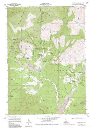
Placerville Topo Map Idaho
To zoom in, hover over the map of Placerville
USGS Topo Quad 43115h8 - 1:24,000 scale
| Topo Map Name: | Placerville |
| USGS Topo Quad ID: | 43115h8 |
| Print Size: | ca. 21 1/4" wide x 27" high |
| Southeast Coordinates: | 43.875° N latitude / 115.875° W longitude |
| Map Center Coordinates: | 43.9375° N latitude / 115.9375° W longitude |
| U.S. State: | ID |
| Filename: | o43115h8.jpg |
| Download Map JPG Image: | Placerville topo map 1:24,000 scale |
| Map Type: | Topographic |
| Topo Series: | 7.5´ |
| Map Scale: | 1:24,000 |
| Source of Map Images: | United States Geological Survey (USGS) |
| Alternate Map Versions: |
Placerville ID 1957, updated 1959 Download PDF Buy paper map Placerville ID 1957, updated 1976 Download PDF Buy paper map Placerville ID 1957, updated 1982 Download PDF Buy paper map Placerville ID 1976, updated 1982 Download PDF Buy paper map Placerville ID 1998, updated 2002 Download PDF Buy paper map Placerville ID 2011 Download PDF Buy paper map Placerville ID 2013 Download PDF Buy paper map |
| FStopo: | US Forest Service topo Placerville is available: Download FStopo PDF Download FStopo TIF |
1:24,000 Topo Quads surrounding Placerville
> Back to 43115e1 at 1:100,000 scale
> Back to 43114a1 at 1:250,000 scale
> Back to U.S. Topo Maps home
Placerville topo map: Gazetteer
Placerville: Basins
Boise Basin elevation 1331m 4366′Placerville: Flats
Huckleberry Flat elevation 1423m 4668′Mud Flat elevation 1311m 4301′
Placerville: Mines
Blackhawk Mine elevation 1438m 4717′Coin Bond Mine elevation 1548m 5078′
Gold Hill Mine elevation 1440m 4724′
Halley Placer Mine elevation 1320m 4330′
Iowa Mine elevation 1435m 4708′
Leary Placer Mine elevation 1330m 4363′
Mayflower Mine elevation 1465m 4806′
Mineral Hill Mine elevation 1553m 5095′
Reid Placer Mine elevation 1369m 4491′
Richland Mine elevation 1451m 4760′
Twin Sisters Mine elevation 1302m 4271′
Placerville: Populated Places
Centerville elevation 1283m 4209′Granite elevation 1340m 4396′
New Centerville elevation 1264m 4146′
Placerville elevation 1318m 4324′
Quartzburg elevation 1425m 4675′
Star Ranch Summer Home Area elevation 1314m 4311′
Placerville: Streams
Canyon Creek elevation 1281m 4202′China Fork elevation 1339m 4393′
Clay Creek elevation 1290m 4232′
Clear Creek elevation 1278m 4192′
East Fork Alder Creek elevation 1306m 4284′
East Fork Clear Creek elevation 1301m 4268′
Fall Creek elevation 1310m 4297′
Henry Creek elevation 1267m 4156′
Lewis Creek elevation 1292m 4238′
Meadow Creek elevation 1256m 4120′
Ophir Creek elevation 1282m 4206′
Thompson Creek elevation 1290m 4232′
Town Creek elevation 1281m 4202′
Trail Creek elevation 1278m 4192′
Trail Creek elevation 1268m 4160′
West Fork Clear Creek elevation 1301m 4268′
West Fork Creek elevation 1287m 4222′
West Fork Granite Creek elevation 1363m 4471′
Woof Creek elevation 1289m 4229′
Placerville: Summits
Alder Creek Summit elevation 1485m 4872′Mineral Mountain elevation 1812m 5944′
Placerville: Valleys
Boston Gulch elevation 1268m 4160′Boyles Gulch elevation 1327m 4353′
California Gulch elevation 1316m 4317′
Chaney Gulch elevation 1324m 4343′
Clouder Gulch elevation 1326m 4350′
Confederate Gulch elevation 1431m 4694′
Fisher Gulch elevation 1381m 4530′
Garden Gulch elevation 1292m 4238′
Illinois Gulch elevation 1330m 4363′
Little Crooked Ravine elevation 1370m 4494′
Mullen Gulch elevation 1340m 4396′
Sailor Gulch elevation 1316m 4317′
Slab Cabin Gulch elevation 1330m 4363′
Slaughterhouse Gulch elevation 1280m 4199′
Twin Sisters Gulch elevation 1285m 4215′
Wet Gulch elevation 1268m 4160′
Placerville digital topo map on disk
Buy this Placerville topo map showing relief, roads, GPS coordinates and other geographical features, as a high-resolution digital map file on DVD:


