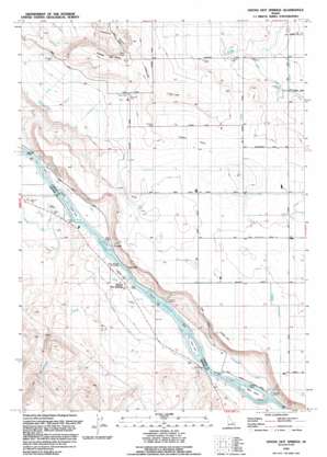
Givens Hot Springs Topo Map Idaho
To zoom in, hover over the map of Givens Hot Springs
USGS Topo Quad 43116d6 - 1:24,000 scale
| Topo Map Name: | Givens Hot Springs |
| USGS Topo Quad ID: | 43116d6 |
| Print Size: | ca. 21 1/4" wide x 27" high |
| Southeast Coordinates: | 43.375° N latitude / 116.625° W longitude |
| Map Center Coordinates: | 43.4375° N latitude / 116.6875° W longitude |
| U.S. State: | ID |
| Filename: | o43116d6.jpg |
| Download Map JPG Image: | Givens Hot Springs topo map 1:24,000 scale |
| Map Type: | Topographic |
| Topo Series: | 7.5´ |
| Map Scale: | 1:24,000 |
| Source of Map Images: | United States Geological Survey (USGS) |
| Alternate Map Versions: |
Givens Hot Springs ID 1958, updated 1959 Download PDF Buy paper map Givens Hot Springs ID 1958, updated 1972 Download PDF Buy paper map Givens Hot Springs ID 1992, updated 1992 Download PDF Buy paper map Givens Hot Springs ID 2010 Download PDF Buy paper map Givens Hot Springs ID 2013 Download PDF Buy paper map |
1:24,000 Topo Quads surrounding Givens Hot Springs
> Back to 43116a1 at 1:100,000 scale
> Back to 43116a1 at 1:250,000 scale
> Back to U.S. Topo Maps home
Givens Hot Springs topo map: Gazetteer
Givens Hot Springs: Airports
Sunrise Skypark elevation 688m 2257′Givens Hot Springs: Basins
Hidden Valley elevation 831m 2726′Givens Hot Springs: Canals
Brooks Lateral elevation 792m 2598′Nicholson Ditch elevation 705m 2312′
Opalene Ditch elevation 712m 2335′
Givens Hot Springs: Islands
Blackburn Island elevation 684m 2244′Current Island elevation 682m 2237′
Dredge Island elevation 684m 2244′
Fischer Island elevation 683m 2240′
Foglers Island elevation 684m 2244′
Goldeneye Island elevation 684m 2244′
Hermit Island elevation 681m 2234′
Raccoon Island elevation 681m 2234′
Richards Island elevation 684m 2244′
Rippee Island elevation 684m 2244′
Ware Island elevation 684m 2244′
Givens Hot Springs: Pillars
Map Rock elevation 696m 2283′Givens Hot Springs: Populated Places
Givens Hot Springs elevation 693m 2273′Givens Hot Springs: Streams
Hardtrigger Creek elevation 682m 2237′Givens Hot Springs: Summits
Pickles Butte elevation 940m 3083′Givens Hot Springs: Valleys
Deadhorse Canyon elevation 787m 2582′Givens Hot Springs digital topo map on disk
Buy this Givens Hot Springs topo map showing relief, roads, GPS coordinates and other geographical features, as a high-resolution digital map file on DVD:


