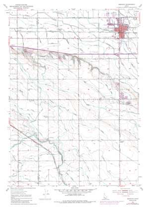
Meridian Topo Map Idaho
To zoom in, hover over the map of Meridian
USGS Topo Quad 43116e4 - 1:24,000 scale
| Topo Map Name: | Meridian |
| USGS Topo Quad ID: | 43116e4 |
| Print Size: | ca. 21 1/4" wide x 27" high |
| Southeast Coordinates: | 43.5° N latitude / 116.375° W longitude |
| Map Center Coordinates: | 43.5625° N latitude / 116.4375° W longitude |
| U.S. State: | ID |
| Filename: | o43116e4.jpg |
| Download Map JPG Image: | Meridian topo map 1:24,000 scale |
| Map Type: | Topographic |
| Topo Series: | 7.5´ |
| Map Scale: | 1:24,000 |
| Source of Map Images: | United States Geological Survey (USGS) |
| Alternate Map Versions: |
Meridian ID 1953, updated 1955 Download PDF Buy paper map Meridian ID 1953, updated 1972 Download PDF Buy paper map Meridian ID 1953, updated 1985 Download PDF Buy paper map Meridian ID 1953, updated 1985 Download PDF Buy paper map Meridian ID 2010 Download PDF Buy paper map Meridian ID 2013 Download PDF Buy paper map |
1:24,000 Topo Quads surrounding Meridian
> Back to 43116e1 at 1:100,000 scale
> Back to 43116a1 at 1:250,000 scale
> Back to U.S. Topo Maps home
Meridian topo map: Gazetteer
Meridian: Canals
Amity Drain elevation 781m 2562′Andrews Lateral elevation 793m 2601′
Beckdolt Lateral elevation 835m 2739′
Calkins Lateral elevation 826m 2709′
Carlson Lateral elevation 833m 2732′
Dewey Lateral elevation 800m 2624′
Duval Lateral elevation 773m 2536′
Eightmile Lateral elevation 795m 2608′
Fieselmann Lateral elevation 790m 2591′
Fogarty Lateral elevation 788m 2585′
Huff Lateral elevation 783m 2568′
Kennedy Lateral elevation 791m 2595′
Kuna Canal elevation 820m 2690′
Mason Creek Feeder elevation 803m 2634′
McBirney Lateral elevation 834m 2736′
Point Lateral elevation 814m 2670′
Ramsey Lateral elevation 817m 2680′
Rawson Canal elevation 826m 2709′
Ridenbaugh Canal elevation 784m 2572′
Ridenbaugh High Line Canal elevation 796m 2611′
Rosenlof Drain elevation 775m 2542′
Rutledge Lateral elevation 784m 2572′
Schott Lateral elevation 790m 2591′
State Lateral elevation 819m 2687′
Sundell Lateral elevation 827m 2713′
Meridian: Populated Places
Meridian elevation 794m 2604′Sonna elevation 774m 2539′
Meridian: Streams
Perkins Drain elevation 769m 2522′Rachel Drain elevation 766m 2513′
Meridian: Valleys
Purdam Gulch elevation 776m 2545′Meridian digital topo map on disk
Buy this Meridian topo map showing relief, roads, GPS coordinates and other geographical features, as a high-resolution digital map file on DVD:


