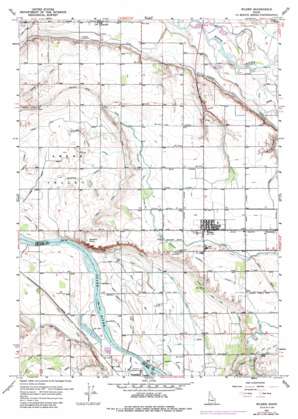
Wilder Topo Map Idaho
To zoom in, hover over the map of Wilder
USGS Topo Quad 43116f8 - 1:24,000 scale
| Topo Map Name: | Wilder |
| USGS Topo Quad ID: | 43116f8 |
| Print Size: | ca. 21 1/4" wide x 27" high |
| Southeast Coordinates: | 43.625° N latitude / 116.875° W longitude |
| Map Center Coordinates: | 43.6875° N latitude / 116.9375° W longitude |
| U.S. State: | ID |
| Filename: | o43116f8.jpg |
| Download Map JPG Image: | Wilder topo map 1:24,000 scale |
| Map Type: | Topographic |
| Topo Series: | 7.5´ |
| Map Scale: | 1:24,000 |
| Source of Map Images: | United States Geological Survey (USGS) |
| Alternate Map Versions: |
Wilder ID 1957, updated 1959 Download PDF Buy paper map Wilder ID 1957, updated 1972 Download PDF Buy paper map Wilder ID 1957, updated 1985 Download PDF Buy paper map Wilder ID 2010 Download PDF Buy paper map Wilder ID 2013 Download PDF Buy paper map |
1:24,000 Topo Quads surrounding Wilder
> Back to 43116e1 at 1:100,000 scale
> Back to 43116a1 at 1:250,000 scale
> Back to U.S. Topo Maps home
Wilder topo map: Gazetteer
Wilder: Canals
Andrews Ditch elevation 687m 2253′Arena Canal elevation 718m 2355′
Arena Lake Drain elevation 693m 2273′
Attell Lateral elevation 742m 2434′
Benson Drain elevation 735m 2411′
Drew Drain elevation 748m 2454′
Drew Lateral elevation 737m 2417′
East Alkali Drain elevation 672m 2204′
Fargo High Line Canal elevation 724m 2375′
Fargo Low Line Canal elevation 700m 2296′
Gem District D Canal elevation 703m 2306′
Golden Gate Canal elevation 745m 2444′
Idaho Lateral elevation 739m 2424′
Johnson Lateral elevation 695m 2280′
Kilbaine Lateral elevation 743m 2437′
Paine Lateral elevation 740m 2427′
Patch Canal elevation 689m 2260′
Plowhead Lateral elevation 705m 2312′
Ross Lateral elevation 737m 2417′
Sheckard Lateral elevation 703m 2306′
Vantress Lateral elevation 746m 2447′
Watts Lateral elevation 709m 2326′
Wordica Lateral elevation 699m 2293′
Wilder: Cliffs
Gravelly Point elevation 743m 2437′Wilder: Islands
Goat Island elevation 675m 2214′Heltons Island elevation 675m 2214′
Wilder: Populated Places
Roswell elevation 690m 2263′Wilder elevation 740m 2427′
Wilder: Streams
Dixie Slough elevation 686m 2250′Parkins Drain elevation 720m 2362′
Succor Creek elevation 674m 2211′
Succor Creek elevation 674m 2211′
Wilder: Valleys
Mammen Gulch elevation 700m 2296′Wilder digital topo map on disk
Buy this Wilder topo map showing relief, roads, GPS coordinates and other geographical features, as a high-resolution digital map file on DVD:


