Parma Se Topo Map Idaho
To zoom in, hover over the map of Parma Se
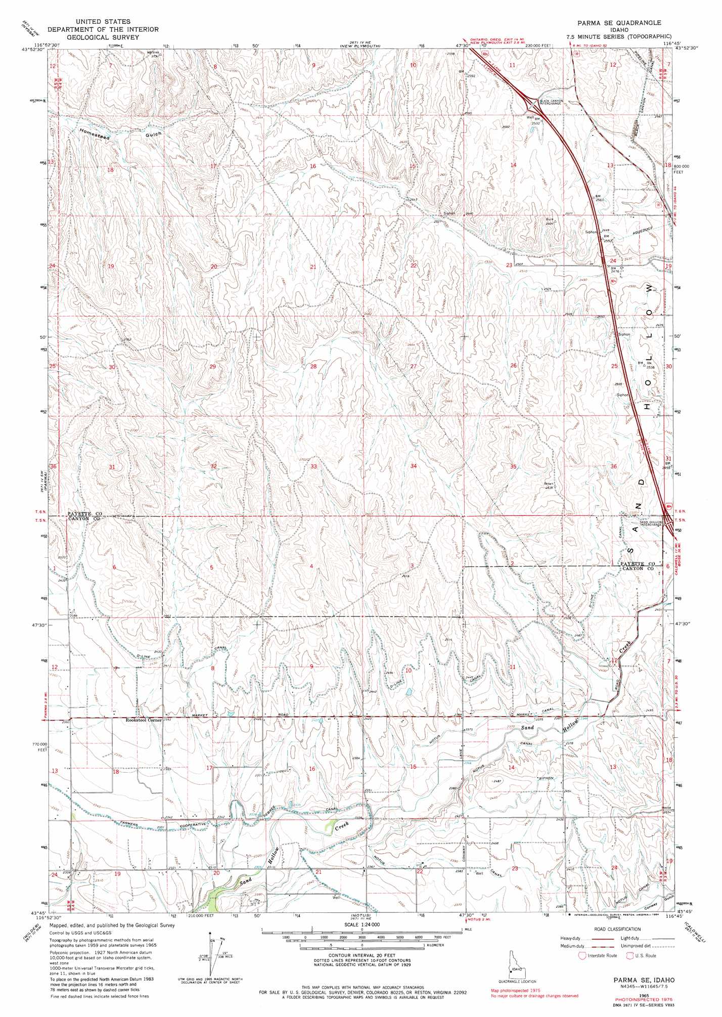
USGS Topo Quad 43116g7 - 1:24,000 scale
| Topo Map Name: | Parma Se |
| USGS Topo Quad ID: | 43116g7 |
| Print Size: | ca. 21 1/4" wide x 27" high |
| Southeast Coordinates: | 43.75° N latitude / 116.75° W longitude |
| Map Center Coordinates: | 43.8125° N latitude / 116.8125° W longitude |
| U.S. State: | ID |
| Filename: | o43116g7.jpg |
| Download Map JPG Image: | Parma Se topo map 1:24,000 scale |
| Map Type: | Topographic |
| Topo Series: | 7.5´ |
| Map Scale: | 1:24,000 |
| Source of Map Images: | United States Geological Survey (USGS) |
| Alternate Map Versions: |
Parma SE ID 1965, updated 1967 Download PDF Buy paper map Parma SE ID 1965, updated 1984 Download PDF Buy paper map Parma SE ID 2010 Download PDF Buy paper map Parma SE ID 2013 Download PDF Buy paper map |
1:24,000 Topo Quads surrounding Parma Se
Malheur Butte |
Payette |
Birding Island |
Sheep Ridge |
Hog Cove Butte |
Cairo |
Nyssa |
New Plymouth |
Letha |
Northwest Emmett |
Owyhee |
Parma |
Parma Se |
Sand Hollow |
Southwest Emmett |
Adrian |
Wilder |
Notus |
Caldwell |
Middleton |
Graveyard Point |
Homedale |
Marsing |
Lake Lowell |
Nampa |
> Back to 43116e1 at 1:100,000 scale
> Back to 43116a1 at 1:250,000 scale
> Back to U.S. Topo Maps home
Parma Se topo map: Gazetteer
Parma Se: Canals
Farmers Cooperative Sebree Canal elevation 715m 2345′Notus Canal elevation 726m 2381′
Parma Se: Populated Places
Rookstool Corner elevation 731m 2398′Parma Se digital topo map on disk
Buy this Parma Se topo map showing relief, roads, GPS coordinates and other geographical features, as a high-resolution digital map file on DVD: