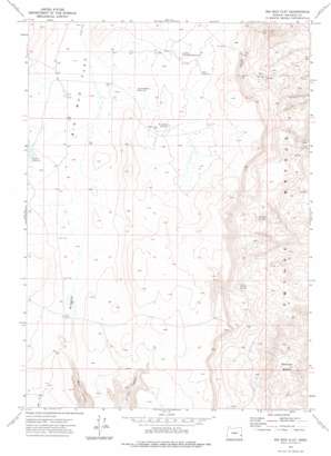
Big Mud Flat Topo Map Oregon
To zoom in, hover over the map of Big Mud Flat
USGS Topo Quad 43117c5 - 1:24,000 scale
| Topo Map Name: | Big Mud Flat |
| USGS Topo Quad ID: | 43117c5 |
| Print Size: | ca. 21 1/4" wide x 27" high |
| Southeast Coordinates: | 43.25° N latitude / 117.5° W longitude |
| Map Center Coordinates: | 43.3125° N latitude / 117.5625° W longitude |
| U.S. State: | OR |
| Filename: | o43117c5.jpg |
| Download Map JPG Image: | Big Mud Flat topo map 1:24,000 scale |
| Map Type: | Topographic |
| Topo Series: | 7.5´ |
| Map Scale: | 1:24,000 |
| Source of Map Images: | United States Geological Survey (USGS) |
| Alternate Map Versions: |
Big Mud Flat OR 1972, updated 1975 Download PDF Buy paper map Big Mud Flat OR 2011 Download PDF Buy paper map Big Mud Flat OR 2014 Download PDF Buy paper map |
1:24,000 Topo Quads surrounding Big Mud Flat
> Back to 43117a1 at 1:100,000 scale
> Back to 43116a1 at 1:250,000 scale
> Back to U.S. Topo Maps home
Big Mud Flat topo map: Gazetteer
Big Mud Flat: Basins
Wrangle Basin elevation 934m 3064′Big Mud Flat: Dams
Black Canyon Creek Dam elevation 1350m 4429′David Kent Dam elevation 1351m 4432′
Big Mud Flat: Flats
Big Mud Flat elevation 1348m 4422′Big Mud Flat: Reservoirs
Ben Odell Reservoir elevation 1349m 4425′David Kent Reservoir elevation 1351m 4432′
Davis Reservoir elevation 1371m 4498′
Harry Page Reservoir elevation 1368m 4488′
Knottingham Reservoir elevation 1351m 4432′
Little Mud Flat Reservoir elevation 1372m 4501′
Palmer Reservoir elevation 1351m 4432′
Big Mud Flat: Springs
Eads Springs elevation 1228m 4028′Whiskey Springs elevation 1155m 3789′
Willow Springs elevation 1235m 4051′
Big Mud Flat: Summits
Owyhee Breaks elevation 1104m 3622′Big Mud Flat: Trails
Eads Hill Trail elevation 1377m 4517′Big Mud Flat digital topo map on disk
Buy this Big Mud Flat topo map showing relief, roads, GPS coordinates and other geographical features, as a high-resolution digital map file on DVD:


