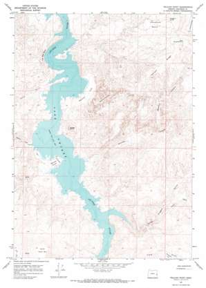
Pelican Point Topo Map Oregon
To zoom in, hover over the map of Pelican Point
USGS Topo Quad 43117d3 - 1:24,000 scale
| Topo Map Name: | Pelican Point |
| USGS Topo Quad ID: | 43117d3 |
| Print Size: | ca. 21 1/4" wide x 27" high |
| Southeast Coordinates: | 43.375° N latitude / 117.25° W longitude |
| Map Center Coordinates: | 43.4375° N latitude / 117.3125° W longitude |
| U.S. State: | OR |
| Filename: | o43117d3.jpg |
| Download Map JPG Image: | Pelican Point topo map 1:24,000 scale |
| Map Type: | Topographic |
| Topo Series: | 7.5´ |
| Map Scale: | 1:24,000 |
| Source of Map Images: | United States Geological Survey (USGS) |
| Alternate Map Versions: |
Pelican Point OR 1967, updated 1971 Download PDF Buy paper map Pelican Point OR 2011 Download PDF Buy paper map Pelican Point OR 2014 Download PDF Buy paper map |
1:24,000 Topo Quads surrounding Pelican Point
> Back to 43117a1 at 1:100,000 scale
> Back to 43116a1 at 1:250,000 scale
> Back to U.S. Topo Maps home
Pelican Point topo map: Gazetteer
Pelican Point: Airports
Owyhee Reservoir State Airport elevation 818m 2683′Pelican Point: Areas
Honeycombs elevation 1113m 3651′Pelican Point: Basins
Sheephead Basin elevation 1208m 3963′Pelican Point: Capes
Pelican Point elevation 818m 2683′Pelican Point: Cliffs
The Big Slide elevation 816m 2677′Pelican Point: Flats
Bensley Flat elevation 823m 2700′Perkins Flat elevation 837m 2746′
Pelican Point: Reservoirs
Painted Canyon Reservoir elevation 1208m 3963′Pelican Point: Ridges
Juniper Ridge elevation 1367m 4484′Sheephead Ridge elevation 1506m 4940′
Pelican Point: Springs
Sheephead Spring elevation 1270m 4166′South Sheephead Spring elevation 1327m 4353′
Pelican Point: Summits
North Table Mountain elevation 1346m 4416′Saddle Butte elevation 1090m 3576′
Pelican Point: Valleys
Acton Gulch elevation 814m 2670′Carlton Canyon elevation 812m 2664′
Deadman Gulch elevation 815m 2673′
Long Gulch elevation 888m 2913′
Painted Canyon elevation 984m 3228′
Three Fingers Gulch elevation 863m 2831′
Pelican Point digital topo map on disk
Buy this Pelican Point topo map showing relief, roads, GPS coordinates and other geographical features, as a high-resolution digital map file on DVD:


