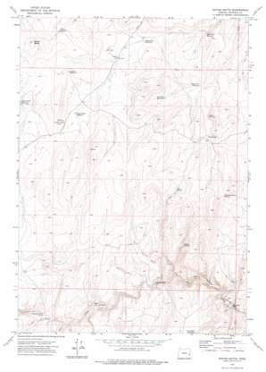
Rufino Butte Topo Map Oregon
To zoom in, hover over the map of Rufino Butte
USGS Topo Quad 43117e6 - 1:24,000 scale
| Topo Map Name: | Rufino Butte |
| USGS Topo Quad ID: | 43117e6 |
| Print Size: | ca. 21 1/4" wide x 27" high |
| Southeast Coordinates: | 43.5° N latitude / 117.625° W longitude |
| Map Center Coordinates: | 43.5625° N latitude / 117.6875° W longitude |
| U.S. State: | OR |
| Filename: | o43117e6.jpg |
| Download Map JPG Image: | Rufino Butte topo map 1:24,000 scale |
| Map Type: | Topographic |
| Topo Series: | 7.5´ |
| Map Scale: | 1:24,000 |
| Source of Map Images: | United States Geological Survey (USGS) |
| Alternate Map Versions: |
Rufino Butte OR 1972, updated 1975 Download PDF Buy paper map Rufino Butte OR 2011 Download PDF Buy paper map Rufino Butte OR 2014 Download PDF Buy paper map |
1:24,000 Topo Quads surrounding Rufino Butte
> Back to 43117e1 at 1:100,000 scale
> Back to 43116a1 at 1:250,000 scale
> Back to U.S. Topo Maps home
Rufino Butte topo map: Gazetteer
Rufino Butte: Crossings
The Big Horse Trails elevation 1179m 3868′The Indian Trails elevation 1116m 3661′
Rufino Butte: Reservoirs
Cabin Reservoir elevation 1337m 4386′Coyote Wells Reservoir elevation 1361m 4465′
Hard Rock Reservoir elevation 1278m 4192′
Leppy Reservoir elevation 1392m 4566′
McConnell Reservoir elevation 1321m 4333′
Palmer Reservoir elevation 1392m 4566′
Pitch Fork Reservoir elevation 1289m 4229′
Rocky Hill Reservoir elevation 1322m 4337′
Two Way Reservoir elevation 1354m 4442′
Rufino Butte: Springs
Canyon Springs elevation 1283m 4209′Mud Spring elevation 1367m 4484′
Slim and Fatty Spring elevation 1445m 4740′
Rufino Butte: Streams
Butte Creek elevation 1204m 3950′Rufino Butte: Summits
Rufino Butte elevation 1510m 4954′Rufino Butte digital topo map on disk
Buy this Rufino Butte topo map showing relief, roads, GPS coordinates and other geographical features, as a high-resolution digital map file on DVD:


