Mitchell Butte Topo Map Oregon
To zoom in, hover over the map of Mitchell Butte
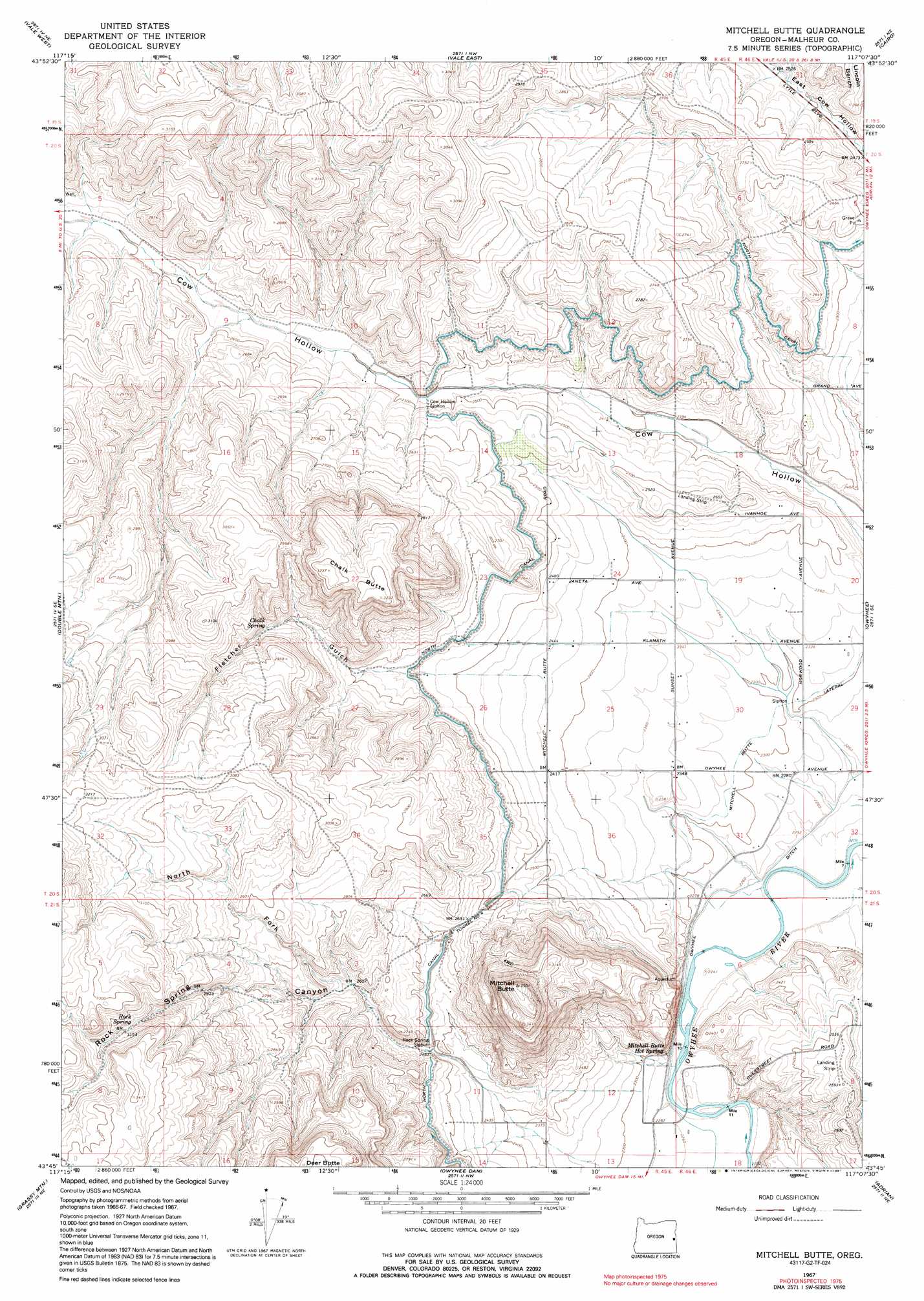
USGS Topo Quad 43117g2 - 1:24,000 scale
| Topo Map Name: | Mitchell Butte |
| USGS Topo Quad ID: | 43117g2 |
| Print Size: | ca. 21 1/4" wide x 27" high |
| Southeast Coordinates: | 43.75° N latitude / 117.125° W longitude |
| Map Center Coordinates: | 43.8125° N latitude / 117.1875° W longitude |
| U.S. State: | OR |
| Filename: | o43117g2.jpg |
| Download Map JPG Image: | Mitchell Butte topo map 1:24,000 scale |
| Map Type: | Topographic |
| Topo Series: | 7.5´ |
| Map Scale: | 1:24,000 |
| Source of Map Images: | United States Geological Survey (USGS) |
| Alternate Map Versions: |
Mitchell Butte OR 1967, updated 1971 Download PDF Buy paper map Mitchell Butte OR 1967, updated 1991 Download PDF Buy paper map Mitchell Butte OR 2011 Download PDF Buy paper map Mitchell Butte OR 2014 Download PDF Buy paper map |
1:24,000 Topo Quads surrounding Mitchell Butte
Hope Butte |
Willow Creek |
Henry Gulch |
Malheur Butte |
Payette |
Vines Hill |
Vale West |
Vale East |
Cairo |
Nyssa |
Kane Spring Gulch |
Double Mountain |
Mitchell Butte |
Owyhee |
Parma |
Sourdough Spring |
Grassy Mountain |
Owyhee Dam |
Adrian |
Wilder |
Twin Springs |
The Elbow |
Owyhee Ridge |
Graveyard Point |
Homedale |
> Back to 43117e1 at 1:100,000 scale
> Back to 43116a1 at 1:250,000 scale
> Back to U.S. Topo Maps home
Mitchell Butte topo map: Gazetteer
Mitchell Butte: Benches
Owyhee Bench elevation 701m 2299′Mitchell Butte: Canals
Rock Spring Siphon elevation 760m 2493′Mitchell Butte: Springs
Chalk Spring elevation 832m 2729′Mitchell Butte Hot Spring elevation 694m 2276′
Rock Spring elevation 959m 3146′
Mitchell Butte: Streams
Rock Spring Creek elevation 798m 2618′Mitchell Butte: Summits
Chalk Butte elevation 985m 3231′Mitchell Butte elevation 1068m 3503′
Mitchell Butte: Valleys
Fletcher Gulch elevation 781m 2562′North Fork Rock Spring Canyon elevation 796m 2611′
Rock Spring Canyon elevation 720m 2362′
Mitchell Butte digital topo map on disk
Buy this Mitchell Butte topo map showing relief, roads, GPS coordinates and other geographical features, as a high-resolution digital map file on DVD: