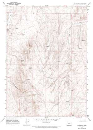
Double Mountain Topo Map Oregon
To zoom in, hover over the map of Double Mountain
USGS Topo Quad 43117g3 - 1:24,000 scale
| Topo Map Name: | Double Mountain |
| USGS Topo Quad ID: | 43117g3 |
| Print Size: | ca. 21 1/4" wide x 27" high |
| Southeast Coordinates: | 43.75° N latitude / 117.25° W longitude |
| Map Center Coordinates: | 43.8125° N latitude / 117.3125° W longitude |
| U.S. State: | OR |
| Filename: | o43117g3.jpg |
| Download Map JPG Image: | Double Mountain topo map 1:24,000 scale |
| Map Type: | Topographic |
| Topo Series: | 7.5´ |
| Map Scale: | 1:24,000 |
| Source of Map Images: | United States Geological Survey (USGS) |
| Alternate Map Versions: |
Double Mtn OR 1967, updated 1971 Download PDF Buy paper map Double Mountain OR 2011 Download PDF Buy paper map Double Mountain OR 2014 Download PDF Buy paper map |
1:24,000 Topo Quads surrounding Double Mountain
> Back to 43117e1 at 1:100,000 scale
> Back to 43116a1 at 1:250,000 scale
> Back to U.S. Topo Maps home
Double Mountain topo map: Gazetteer
Double Mountain: Dams
Two Forks Check Dam elevation 918m 3011′Double Mountain: Reservoirs
Canyon Reservoir elevation 1008m 3307′Chalk Reservoir elevation 885m 2903′
Leaky Reservoir elevation 849m 2785′
Lower Cow Reservoir elevation 895m 2936′
Upper Cow Reservoir elevation 1044m 3425′
Yellowjacket Reservoir elevation 1038m 3405′
Double Mountain: Springs
Bentonite Spring elevation 795m 2608′Cow Hollow Spring elevation 948m 3110′
D M Spring elevation 1054m 3458′
Double Mount Spring elevation 936m 3070′
Mud Spring elevation 930m 3051′
No Name Springs elevation 1038m 3405′
Rimtop Spring elevation 1122m 3681′
Twin Butte Spring elevation 885m 2903′
Willow Spring elevation 788m 2585′
Double Mountain: Summits
Double Mountain elevation 1098m 3602′Shell Rock Butte elevation 1142m 3746′
Double Mountain digital topo map on disk
Buy this Double Mountain topo map showing relief, roads, GPS coordinates and other geographical features, as a high-resolution digital map file on DVD:


