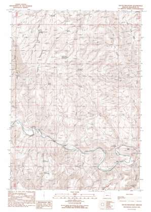
South Mountain Topo Map Oregon
To zoom in, hover over the map of South Mountain
USGS Topo Quad 43117g7 - 1:24,000 scale
| Topo Map Name: | South Mountain |
| USGS Topo Quad ID: | 43117g7 |
| Print Size: | ca. 21 1/4" wide x 27" high |
| Southeast Coordinates: | 43.75° N latitude / 117.75° W longitude |
| Map Center Coordinates: | 43.8125° N latitude / 117.8125° W longitude |
| U.S. State: | OR |
| Filename: | o43117g7.jpg |
| Download Map JPG Image: | South Mountain topo map 1:24,000 scale |
| Map Type: | Topographic |
| Topo Series: | 7.5´ |
| Map Scale: | 1:24,000 |
| Source of Map Images: | United States Geological Survey (USGS) |
| Alternate Map Versions: |
South Mountain OR 1990, updated 1990 Download PDF Buy paper map South Mountain OR 2011 Download PDF Buy paper map South Mountain OR 2014 Download PDF Buy paper map |
1:24,000 Topo Quads surrounding South Mountain
> Back to 43117e1 at 1:100,000 scale
> Back to 43116a1 at 1:250,000 scale
> Back to U.S. Topo Maps home
South Mountain topo map: Gazetteer
South Mountain: Populated Places
Bohna (historical) elevation 829m 2719′South Mountain: Post Offices
Mason Post Office (historical) elevation 853m 2798′South Mountain: Reservoirs
Alfred Reservoir elevation 1287m 4222′Hog Creek Reservoir Number Two elevation 1430m 4691′
South Cottonwood Reservoir elevation 1372m 4501′
South Mountain Reservoir elevation 1312m 4304′
Tub Springs Reservoir elevation 1289m 4229′
South Mountain: Springs
Boney Spring Number 1 elevation 1113m 3651′Boney Spring Number 2 elevation 1196m 3923′
Coyne Spring elevation 1307m 4288′
Coyote Spring elevation 1340m 4396′
Perry Spring elevation 1129m 3704′
Rim Spring elevation 1415m 4642′
Rimrock Spring elevation 1339m 4393′
Simmons Gulch Spring elevation 974m 3195′
South Mountain: Streams
China Creek elevation 832m 2729′Gold Creek elevation 827m 2713′
Hog Creek elevation 810m 2657′
Miller Creek elevation 810m 2657′
Sperry Creek elevation 836m 2742′
Spring Creek elevation 844m 2769′
South Mountain: Summits
South Mountain elevation 1593m 5226′South Mountain: Valleys
Simmons Gulch elevation 809m 2654′South Mountain digital topo map on disk
Buy this South Mountain topo map showing relief, roads, GPS coordinates and other geographical features, as a high-resolution digital map file on DVD:


