Cairo Topo Map Oregon
To zoom in, hover over the map of Cairo
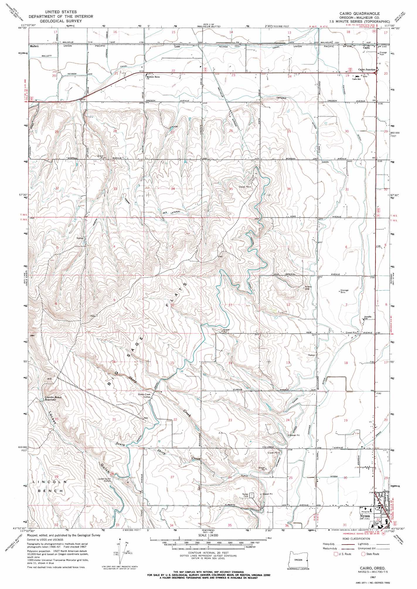
USGS Topo Quad 43117h1 - 1:24,000 scale
| Topo Map Name: | Cairo |
| USGS Topo Quad ID: | 43117h1 |
| Print Size: | ca. 21 1/4" wide x 27" high |
| Southeast Coordinates: | 43.875° N latitude / 117° W longitude |
| Map Center Coordinates: | 43.9375° N latitude / 117.0625° W longitude |
| U.S. State: | OR |
| Filename: | o43117h1.jpg |
| Download Map JPG Image: | Cairo topo map 1:24,000 scale |
| Map Type: | Topographic |
| Topo Series: | 7.5´ |
| Map Scale: | 1:24,000 |
| Source of Map Images: | United States Geological Survey (USGS) |
| Alternate Map Versions: |
Cairo OR 1967, updated 1971 Download PDF Buy paper map Cairo OR 2011 Download PDF Buy paper map Cairo OR 2014 Download PDF Buy paper map |
1:24,000 Topo Quads surrounding Cairo
Mccarthy Ridge |
Tub Mountain |
Moores Hollow |
Weiser South |
Weiser Cove |
Willow Creek |
Henry Gulch |
Malheur Butte |
Payette |
Birding Island |
Vale West |
Vale East |
Cairo |
Nyssa |
New Plymouth |
Double Mountain |
Mitchell Butte |
Owyhee |
Parma |
Parma Se |
Grassy Mountain |
Owyhee Dam |
Adrian |
Wilder |
Notus |
> Back to 43117e1 at 1:100,000 scale
> Back to 43116a1 at 1:250,000 scale
> Back to U.S. Topo Maps home
Cairo topo map: Gazetteer
Cairo: Benches
Lincoln Bench elevation 818m 2683′Cairo: Canals
Jordan Drain elevation 669m 2194′Locket Gulch Siphon elevation 761m 2496′
Malheur Siphon elevation 688m 2257′
Mallett Drain elevation 669m 2194′
Nevada Canal elevation 673m 2208′
North Canal Lateral elevation 763m 2503′
Nyssa Drain elevation 665m 2181′
Nyssa-Arcadia Drain elevation 665m 2181′
Ontario Nyssa Canal elevation 700m 2296′
Sheep Creek Siphon elevation 767m 2516′
Cairo: Dams
Albertsons Dam elevation 796m 2611′Cairo: Flats
Big Sage Flats elevation 826m 2709′Cairo: Populated Places
Cairo elevation 668m 2191′Nyssa Heights elevation 674m 2211′
Cairo: Reservoirs
Albertsons Reservoir 'A' elevation 796m 2611′Lincoln Bench Reservoir elevation 797m 2614′
Cairo: Streams
Sheep Creek elevation 692m 2270′South Sheep Creek elevation 695m 2280′
Cairo digital topo map on disk
Buy this Cairo topo map showing relief, roads, GPS coordinates and other geographical features, as a high-resolution digital map file on DVD: