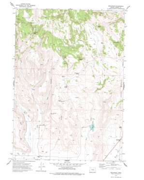
Buchanan Topo Map Oregon
To zoom in, hover over the map of Buchanan
USGS Topo Quad 43118f6 - 1:24,000 scale
| Topo Map Name: | Buchanan |
| USGS Topo Quad ID: | 43118f6 |
| Print Size: | ca. 21 1/4" wide x 27" high |
| Southeast Coordinates: | 43.625° N latitude / 118.625° W longitude |
| Map Center Coordinates: | 43.6875° N latitude / 118.6875° W longitude |
| U.S. State: | OR |
| Filename: | o43118f6.jpg |
| Download Map JPG Image: | Buchanan topo map 1:24,000 scale |
| Map Type: | Topographic |
| Topo Series: | 7.5´ |
| Map Scale: | 1:24,000 |
| Source of Map Images: | United States Geological Survey (USGS) |
| Alternate Map Versions: |
Buchanan OR 1973, updated 1977 Download PDF Buy paper map Buchanan OR 1999, updated 2002 Download PDF Buy paper map Buchanan OR 2011 Download PDF Buy paper map Buchanan OR 2014 Download PDF Buy paper map |
| FStopo: | US Forest Service topo Buchanan is available: Download FStopo PDF Download FStopo TIF |
1:24,000 Topo Quads surrounding Buchanan
> Back to 43118e1 at 1:100,000 scale
> Back to 43118a1 at 1:250,000 scale
> Back to U.S. Topo Maps home
Buchanan topo map: Gazetteer
Buchanan: Canals
H V I Company Ditch elevation 1263m 4143′Buchanan: Flats
Oard Flat elevation 1409m 4622′Poujade Field elevation 1572m 5157′
Buchanan: Parks
Great Basin Historical Marker elevation 1284m 4212′Buchanan: Populated Places
Buchanan elevation 1284m 4212′Buchanan: Post Offices
Buchanan Post Office (historical) elevation 1284m 4212′Buchanan: Reservoirs
Corcoran Reservoir elevation 1281m 4202′Cow Creek Road Reservoir elevation 1381m 4530′
Lower Jones Canyon Reservoir elevation 1309m 4294′
Upper Jones Canyon Reservoir elevation 1424m 4671′
Buchanan: Springs
Cabin Spring elevation 1554m 5098′Demeris Spring elevation 1634m 5360′
Forseer Spring elevation 1485m 4872′
Jake Green Spring elevation 1489m 4885′
Loggan Springs elevation 1326m 4350′
Mud Spring elevation 1418m 4652′
Rattlesnake Spring elevation 1495m 4904′
Rinfroe Springs elevation 1408m 4619′
Temple Spring elevation 1429m 4688′
Buchanan: Streams
Big Rock Creek elevation 1269m 4163′Cow Creek elevation 1263m 4143′
East Cow Creek elevation 1264m 4146′
Buchanan: Valleys
Cow Creek Valley elevation 1272m 4173′East Canyon elevation 1294m 4245′
Jones Canyon elevation 1269m 4163′
Buchanan digital topo map on disk
Buy this Buchanan topo map showing relief, roads, GPS coordinates and other geographical features, as a high-resolution digital map file on DVD:


