House Butte Topo Map Oregon
To zoom in, hover over the map of House Butte
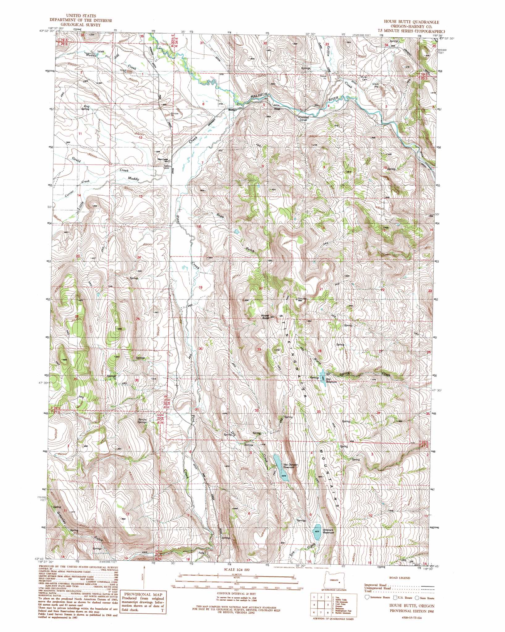
USGS Topo Quad 43118g5 - 1:24,000 scale
| Topo Map Name: | House Butte |
| USGS Topo Quad ID: | 43118g5 |
| Print Size: | ca. 21 1/4" wide x 27" high |
| Southeast Coordinates: | 43.75° N latitude / 118.5° W longitude |
| Map Center Coordinates: | 43.8125° N latitude / 118.5625° W longitude |
| U.S. State: | OR |
| Filename: | o43118g5.jpg |
| Download Map JPG Image: | House Butte topo map 1:24,000 scale |
| Map Type: | Topographic |
| Topo Series: | 7.5´ |
| Map Scale: | 1:24,000 |
| Source of Map Images: | United States Geological Survey (USGS) |
| Alternate Map Versions: |
House Butte OR 1990, updated 1991 Download PDF Buy paper map House Butte OR 2011 Download PDF Buy paper map House Butte OR 2014 Download PDF Buy paper map |
1:24,000 Topo Quads surrounding House Butte
Jumpoff Joe Mountain |
Magpie Table |
Dollar Basin |
Knox Mountain |
Buck Trough Spring |
Calamity Butte |
Van |
Moffit Table |
Otis Mountain |
Cottonwood Reservoir |
Telephone Butte |
Craft Point |
House Butte |
Drewsey |
Drinkwater Pass |
Harney |
Buchanan |
Stinkingwater Pass |
Bartlett Mountain |
Upton Mountain |
Ninemile Slough |
Carson Point |
Mahon Creek |
Coleman Mountain |
Warm Springs Creek |
> Back to 43118e1 at 1:100,000 scale
> Back to 43118a1 at 1:250,000 scale
> Back to U.S. Topo Maps home
House Butte topo map: Gazetteer
House Butte: Dams
Vanderveer Dam elevation 1305m 4281′House Butte: Reservoirs
Rimrock Reservoir elevation 1334m 4376′Sitz Reservoir elevation 1358m 4455′
Van Derveer Reservoir elevation 1305m 4281′
House Butte: Springs
King Spring elevation 1169m 3835′Renfro Springs elevation 1197m 3927′
Scrub Bull Spring elevation 1381m 4530′
House Butte: Streams
Currier Creek elevation 1147m 3763′Dry Creek elevation 1163m 3815′
Gould Creek elevation 1141m 3743′
Griffin Creek elevation 1122m 3681′
Little Muddy Creek elevation 1130m 3707′
Little Pine Creek elevation 1199m 3933′
Muddy Creek elevation 1137m 3730′
Pine Creek elevation 1129m 3704′
House Butte: Summits
House Butte elevation 1454m 4770′House Butte: Valleys
Greenley Gulch elevation 1263m 4143′Scab Gulch elevation 1142m 3746′
House Butte digital topo map on disk
Buy this House Butte topo map showing relief, roads, GPS coordinates and other geographical features, as a high-resolution digital map file on DVD: