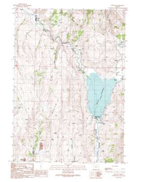
Beulah Topo Map Oregon
To zoom in, hover over the map of Beulah
USGS Topo Quad 43118h2 - 1:24,000 scale
| Topo Map Name: | Beulah |
| USGS Topo Quad ID: | 43118h2 |
| Print Size: | ca. 21 1/4" wide x 27" high |
| Southeast Coordinates: | 43.875° N latitude / 118.125° W longitude |
| Map Center Coordinates: | 43.9375° N latitude / 118.1875° W longitude |
| U.S. State: | OR |
| Filename: | o43118h2.jpg |
| Download Map JPG Image: | Beulah topo map 1:24,000 scale |
| Map Type: | Topographic |
| Topo Series: | 7.5´ |
| Map Scale: | 1:24,000 |
| Source of Map Images: | United States Geological Survey (USGS) |
| Alternate Map Versions: |
Beulah OR 1990, updated 1991 Download PDF Buy paper map Beulah OR 2011 Download PDF Buy paper map Beulah OR 2014 Download PDF Buy paper map |
1:24,000 Topo Quads surrounding Beulah
> Back to 43118e1 at 1:100,000 scale
> Back to 43118a1 at 1:250,000 scale
> Back to U.S. Topo Maps home
Beulah topo map: Gazetteer
Beulah: Dams
Agency Valley Dam elevation 1009m 3310′Scott Dam elevation 1107m 3631′
Beulah: Lakes
Dry Lake elevation 1129m 3704′Beulah: Populated Places
Beulah elevation 1001m 3284′Beulah: Post Offices
Beulah Post Office (historical) elevation 1001m 3284′Beulah: Reservoirs
Beulah Reservoir elevation 1019m 3343′Scott Reservoir elevation 1107m 3631′
Beulah: Springs
Box Spring elevation 1331m 4366′Charcoal Spring elevation 1298m 4258′
Cherry Spring elevation 1340m 4396′
Fan Spring elevation 1204m 3950′
Fox Spring elevation 1246m 4087′
Green Spot Spring elevation 1065m 3494′
Lower Mud Spring elevation 1128m 3700′
Morrison Spring elevation 1114m 3654′
T J Spring elevation 1272m 4173′
Thorn Spring elevation 1013m 3323′
Beulah: Streams
Castle Rock Creek elevation 1082m 3549′Spring Creek elevation 1092m 3582′
Warm Springs Creek elevation 1019m 3343′
Beulah: Summits
Agency Mountain elevation 1534m 5032′Beulah: Valleys
Agency Valley elevation 1021m 3349′Jerry Canyon elevation 1104m 3622′
Water Gulch elevation 1092m 3582′
Beulah digital topo map on disk
Buy this Beulah topo map showing relief, roads, GPS coordinates and other geographical features, as a high-resolution digital map file on DVD:


