Twin Buttes Topo Map Oregon
To zoom in, hover over the map of Twin Buttes
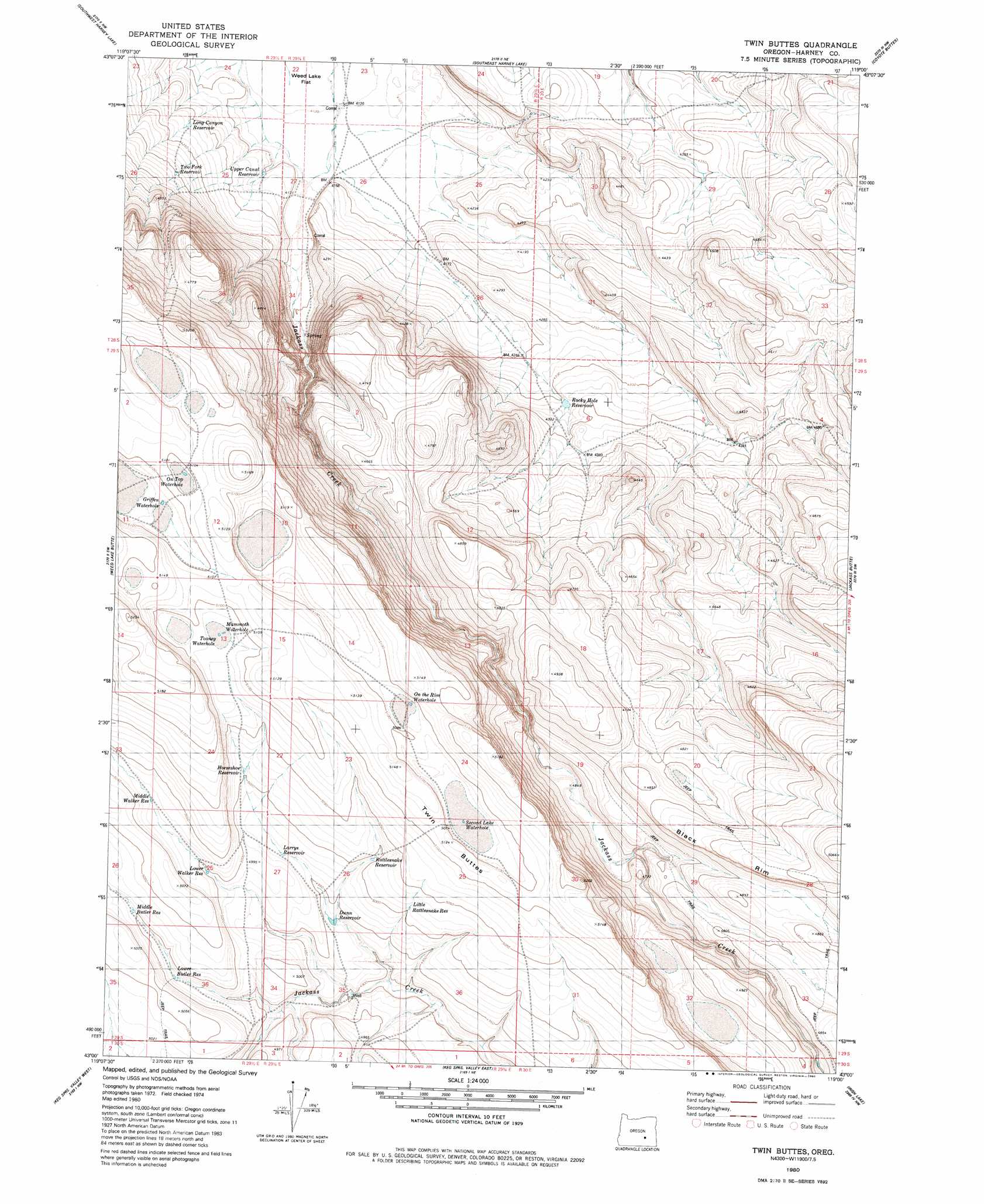
USGS Topo Quad 43119a1 - 1:24,000 scale
| Topo Map Name: | Twin Buttes |
| USGS Topo Quad ID: | 43119a1 |
| Print Size: | ca. 21 1/4" wide x 27" high |
| Southeast Coordinates: | 43° N latitude / 119° W longitude |
| Map Center Coordinates: | 43.0625° N latitude / 119.0625° W longitude |
| U.S. State: | OR |
| Filename: | o43119a1.jpg |
| Download Map JPG Image: | Twin Buttes topo map 1:24,000 scale |
| Map Type: | Topographic |
| Topo Series: | 7.5´ |
| Map Scale: | 1:24,000 |
| Source of Map Images: | United States Geological Survey (USGS) |
| Alternate Map Versions: |
Twin Buttes OR 1980, updated 1980 Download PDF Buy paper map Twin Buttes OR 2011 Download PDF Buy paper map Twin Buttes OR 2014 Download PDF Buy paper map |
1:24,000 Topo Quads surrounding Twin Buttes
Stinking Lake |
Northwest Harney Lake |
Northeast Harney Lake |
The Narrows |
Malheur Lake West |
Hughet Spring |
Southwest Harney Lake |
Southeast Harney Lake |
Coyote Buttes |
Jackass Butte Ne |
Meadow Lake |
Weed Lake Butte |
Twin Buttes |
Jackass Butte |
Diamond Swamp |
Clover Swale |
Keg Sprs Valley West |
Keg Sprs Valley East |
Irish Lake |
Krumbo Reservoir |
Duhaime Flat West |
Duhaime Flat East |
Walls Lake |
Frenchglen |
Page Springs |
> Back to 43119a1 at 1:100,000 scale
> Back to 43118a1 at 1:250,000 scale
> Back to U.S. Topo Maps home
Twin Buttes topo map: Gazetteer
Twin Buttes: Reservoirs
Dunn Reservoir elevation 1505m 4937′Griffen Waterhole elevation 1550m 5085′
Horse Haven Reservoir elevation 1462m 4796′
Horseshoe Reservoir elevation 1528m 5013′
Larrys Reservoir elevation 1514m 4967′
Little Rattlesnake Reservoir elevation 1528m 5013′
Long Canyon Reservoir elevation 1287m 4222′
Lower Butler Reservoir elevation 1518m 4980′
Lower Walker Reservoir elevation 1524m 5000′
Mammoth Waterhole elevation 1551m 5088′
Middle Butler Reservoir elevation 1527m 5009′
Middle Walker Reservoir elevation 1532m 5026′
On the Rim Waterhold elevation 1552m 5091′
On Top Waterhole elevation 1555m 5101′
Rattlesnake Reservoir elevation 1524m 5000′
Rocky Hole Reservoir elevation 1317m 4320′
Second Lake Reservoir elevation 1548m 5078′
Tooney Waterhole elevation 1551m 5088′
Two Fork Reservoir elevation 1314m 4311′
Upper Canal Reservoir elevation 1269m 4163′
Twin Buttes: Summits
Twin Buttes elevation 1563m 5127′Twin Buttes digital topo map on disk
Buy this Twin Buttes topo map showing relief, roads, GPS coordinates and other geographical features, as a high-resolution digital map file on DVD: