Dry Valley Rim Topo Map Oregon
To zoom in, hover over the map of Dry Valley Rim
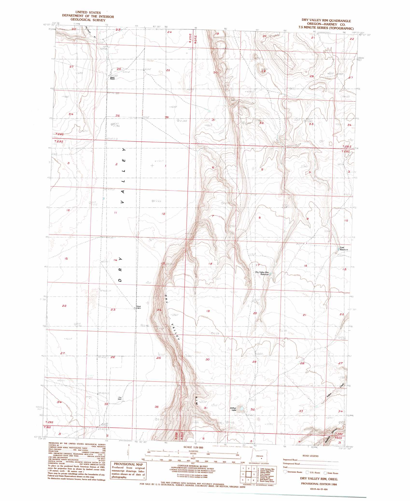
USGS Topo Quad 43119a6 - 1:24,000 scale
| Topo Map Name: | Dry Valley Rim |
| USGS Topo Quad ID: | 43119a6 |
| Print Size: | ca. 21 1/4" wide x 27" high |
| Southeast Coordinates: | 43° N latitude / 119.625° W longitude |
| Map Center Coordinates: | 43.0625° N latitude / 119.6875° W longitude |
| U.S. State: | OR |
| Filename: | o43119a6.jpg |
| Download Map JPG Image: | Dry Valley Rim topo map 1:24,000 scale |
| Map Type: | Topographic |
| Topo Series: | 7.5´ |
| Map Scale: | 1:24,000 |
| Source of Map Images: | United States Geological Survey (USGS) |
| Alternate Map Versions: |
Dry Valley Rim OR 1984, updated 1984 Download PDF Buy paper map Dry Valley Rim OR 2011 Download PDF Buy paper map Dry Valley Rim OR 2014 Download PDF Buy paper map |
1:24,000 Topo Quads surrounding Dry Valley Rim
Wagontire Mountain West |
Wagontire Mountain East |
Alec Butte |
Lake On The Trail |
Iron Mountain Flat |
Locust Butte |
Little Juniper Mountain |
Goose Egg Butte |
Wilson Butte |
Lunch Lake |
Venator Canyon |
Cox Canyon |
Dry Valley Rim |
Rawhide Canyon |
Flybee Lake |
Juniper Mountain |
Turpin Knoll |
Red Bank Lakes |
Rock Camp Draw |
Balls Lake |
Sagebrush Knoll |
Corn Lake |
Corporation Rim |
Steamboat Point |
Orejana Canyon |
> Back to 43119a1 at 1:100,000 scale
> Back to 43118a1 at 1:250,000 scale
> Back to U.S. Topo Maps home
Dry Valley Rim topo map: Gazetteer
Dry Valley Rim: Cliffs
Dry Valley Rim elevation 1481m 4858′Dry Valley Rim: Streams
Juniper Creek elevation 1379m 4524′Dry Valley Rim: Valleys
Dry Valley elevation 1377m 4517′Dry Valley Rim digital topo map on disk
Buy this Dry Valley Rim topo map showing relief, roads, GPS coordinates and other geographical features, as a high-resolution digital map file on DVD: