Locust Butte Topo Map Oregon
To zoom in, hover over the map of Locust Butte
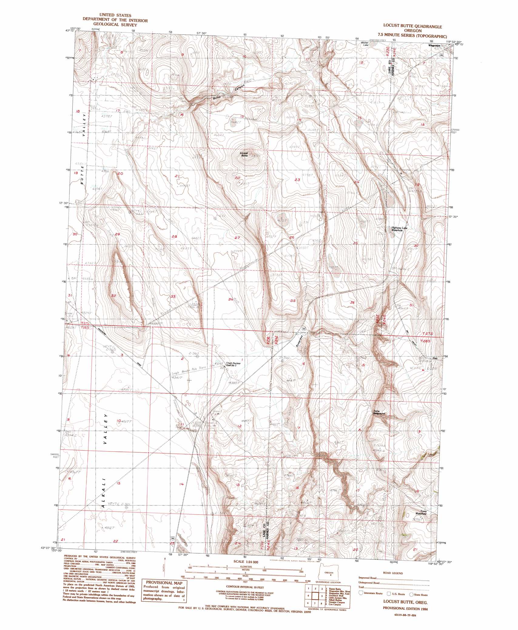
USGS Topo Quad 43119b8 - 1:24,000 scale
| Topo Map Name: | Locust Butte |
| USGS Topo Quad ID: | 43119b8 |
| Print Size: | ca. 21 1/4" wide x 27" high |
| Southeast Coordinates: | 43.125° N latitude / 119.875° W longitude |
| Map Center Coordinates: | 43.1875° N latitude / 119.9375° W longitude |
| U.S. State: | OR |
| Filename: | o43119b8.jpg |
| Download Map JPG Image: | Locust Butte topo map 1:24,000 scale |
| Map Type: | Topographic |
| Topo Series: | 7.5´ |
| Map Scale: | 1:24,000 |
| Source of Map Images: | United States Geological Survey (USGS) |
| Alternate Map Versions: |
Locust Butte OR 1984, updated 1984 Download PDF Buy paper map Locust Butte OR 2011 Download PDF Buy paper map Locust Butte OR 2014 Download PDF Buy paper map |
1:24,000 Topo Quads surrounding Locust Butte
Chicago Valley |
Tired Horse Butte |
Round Top Butte |
Hay Lake |
Squaw Butte |
Elk Butte |
Rams Butte |
Wagontire Mountain West |
Wagontire Mountain East |
Alec Butte |
Horse Mountain |
Goodrich Well |
Locust Butte |
Little Juniper Mountain |
Goose Egg Butte |
Poverty Basin North |
Alkali Buttes |
Venator Canyon |
Cox Canyon |
Dry Valley Rim |
Poverty Basin South |
Alkali Lake |
Juniper Mountain |
Turpin Knoll |
Red Bank Lakes |
> Back to 43119a1 at 1:100,000 scale
> Back to 43118a1 at 1:250,000 scale
> Back to U.S. Topo Maps home
Locust Butte topo map: Gazetteer
Locust Butte: Lakes
Shroder Waterhole elevation 1502m 4927′Wolter Lake elevation 1442m 4730′
Locust Butte: Populated Places
Wagontire elevation 1444m 4737′Locust Butte: Post Offices
Butte Post Office (historical) elevation 1344m 4409′Wagontire Post Office (historical) elevation 1444m 4737′
Locust Butte: Reservoirs
Locust Butte Reservoir elevation 1376m 4514′Locust Butte: Springs
Highway Lake Waterhole elevation 1430m 4691′Toms Waterhole elevation 1515m 4970′
Locust Butte digital topo map on disk
Buy this Locust Butte topo map showing relief, roads, GPS coordinates and other geographical features, as a high-resolution digital map file on DVD: