Squaw Butte Topo Map Oregon
To zoom in, hover over the map of Squaw Butte
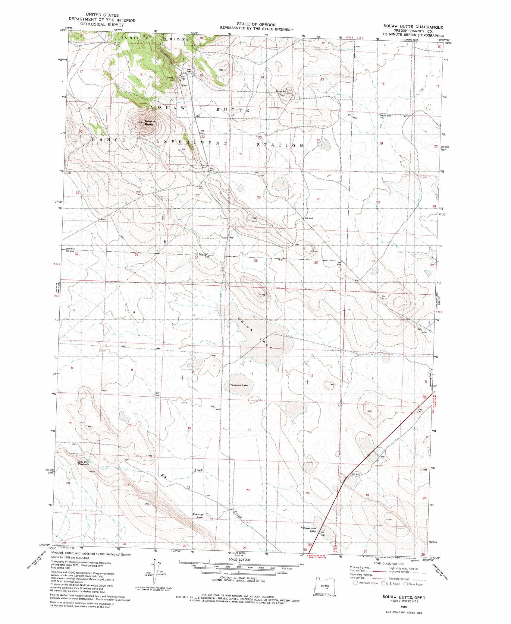
USGS Topo Quad 43119d6 - 1:24,000 scale
| Topo Map Name: | Squaw Butte |
| USGS Topo Quad ID: | 43119d6 |
| Print Size: | ca. 21 1/4" wide x 27" high |
| Southeast Coordinates: | 43.375° N latitude / 119.625° W longitude |
| Map Center Coordinates: | 43.4375° N latitude / 119.6875° W longitude |
| U.S. State: | OR |
| Filename: | o43119d6.jpg |
| Download Map JPG Image: | Squaw Butte topo map 1:24,000 scale |
| Map Type: | Topographic |
| Topo Series: | 7.5´ |
| Map Scale: | 1:24,000 |
| Source of Map Images: | United States Geological Survey (USGS) |
| Alternate Map Versions: |
Squaw Butte OR 1980, updated 1980 Download PDF Buy paper map Paiute Butte OR 2011 Download PDF Buy paper map Paiute Butte OR 2014 Download PDF Buy paper map |
1:24,000 Topo Quads surrounding Squaw Butte
Dust Bowl |
Bulger Ridge |
Camp Currey Spring |
Dry Mountain |
Egypt Canyon |
Hat Butte |
Potato Hills |
Suntex |
Riley |
Oakerman Lakes |
Round Top Butte |
Hay Lake |
Squaw Butte |
Capehart Lake |
Moon Reservoir |
Wagontire Mountain West |
Wagontire Mountain East |
Alec Butte |
Lake On The Trail |
Iron Mountain Flat |
Locust Butte |
Little Juniper Mountain |
Goose Egg Butte |
Wilson Butte |
Lunch Lake |
> Back to 43119a1 at 1:100,000 scale
> Back to 43118a1 at 1:250,000 scale
> Back to U.S. Topo Maps home
Squaw Butte topo map: Gazetteer
Squaw Butte: Flats
China Lake elevation 1355m 4445′Evening Lake elevation 1350m 4429′
Papoose Lake elevation 1353m 4438′
Yellowstone Lake elevation 1352m 4435′
Squaw Butte: Lakes
Yellowstone Waterhole elevation 1356m 4448′Squaw Butte: Reservoirs
Lone Tree Reservoir elevation 1377m 4517′Squaw Butte: Summits
Paiute Butte elevation 1676m 5498′Squaw Butte: Wells
Piersol Well elevation 1380m 4527′Squaw Butte digital topo map on disk
Buy this Squaw Butte topo map showing relief, roads, GPS coordinates and other geographical features, as a high-resolution digital map file on DVD: