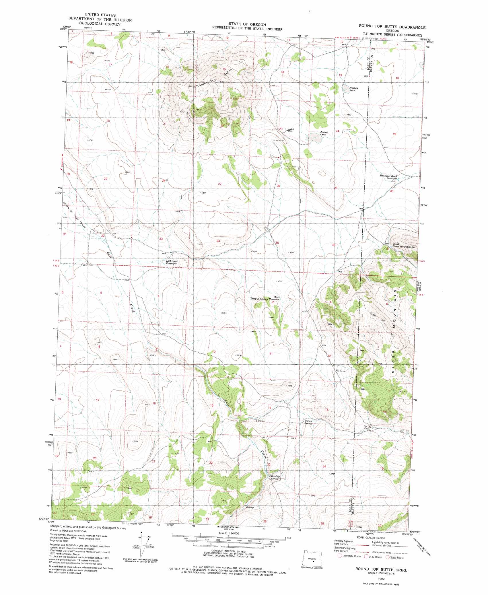
Round Top Butte Topo Map Oregon
To zoom in, hover over the map of Round Top Butte
USGS Topo Quad 43119d8 - 1:24,000 scale
| Topo Map Name: | Round Top Butte |
| USGS Topo Quad ID: | 43119d8 |
| Print Size: | ca. 21 1/4" wide x 27" high |
| Southeast Coordinates: | 43.375° N latitude / 119.875° W longitude |
| Map Center Coordinates: | 43.4375° N latitude / 119.9375° W longitude |
| U.S. State: | OR |
| Filename: | o43119d8.jpg |
| Download Map JPG Image: | Round Top Butte topo map 1:24,000 scale |
| Map Type: | Topographic |
| Topo Series: | 7.5´ |
| Map Scale: | 1:24,000 |
| Source of Map Images: | United States Geological Survey (USGS) |
| Alternate Map Versions: |
Round Top Butte OR 1980, updated 1980 Download PDF Buy paper map Round Top Butte OR 2011 Download PDF Buy paper map Round Top Butte OR 2014 Download PDF Buy paper map |
1:24,000 Topo Quads surrounding Round Top Butte
Hampton |
Misery Flat |
Dust Bowl |
Bulger Ridge |
Camp Currey Spring |
Potato Lake |
Glass Butte |
Hat Butte |
Potato Hills |
Suntex |
Chicago Valley |
Tired Horse Butte |
Round Top Butte |
Hay Lake |
Squaw Butte |
Elk Butte |
Rams Butte |
Wagontire Mountain West |
Wagontire Mountain East |
Alec Butte |
Horse Mountain |
Goodrich Well |
Locust Butte |
Little Juniper Mountain |
Goose Egg Butte |
> Back to 43119a1 at 1:100,000 scale
> Back to 43118a1 at 1:250,000 scale
> Back to U.S. Topo Maps home
Round Top Butte topo map: Gazetteer
Round Top Butte: Basins
Sinks of Lost Creek elevation 1397m 4583′Round Top Butte: Flats
Anderl Lake elevation 1468m 4816′Pasture Lake elevation 1475m 4839′
Round Top Butte: Reservoirs
Lost Creek Reservoir elevation 1410m 4625′Manoeuver Road Reservoir elevation 1432m 4698′
North Sheep Mountain Reservoir elevation 1488m 4881′
West Sheep Mountain Reservoir elevation 1448m 4750′
Round Top Butte: Springs
Bradley Spring elevation 1522m 4993′Dolton Spring elevation 1517m 4977′
Skookum Spring elevation 1521m 4990′
Round Top Butte: Summits
Round Top Butte elevation 1754m 5754′Sheep Mountain elevation 1688m 5538′
Round Top Butte digital topo map on disk
Buy this Round Top Butte topo map showing relief, roads, GPS coordinates and other geographical features, as a high-resolution digital map file on DVD: