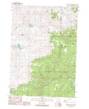
Delintment Lake Topo Map Oregon
To zoom in, hover over the map of Delintment Lake
USGS Topo Quad 43119h6 - 1:24,000 scale
| Topo Map Name: | Delintment Lake |
| USGS Topo Quad ID: | 43119h6 |
| Print Size: | ca. 21 1/4" wide x 27" high |
| Southeast Coordinates: | 43.875° N latitude / 119.625° W longitude |
| Map Center Coordinates: | 43.9375° N latitude / 119.6875° W longitude |
| U.S. State: | OR |
| Filename: | o43119h6.jpg |
| Download Map JPG Image: | Delintment Lake topo map 1:24,000 scale |
| Map Type: | Topographic |
| Topo Series: | 7.5´ |
| Map Scale: | 1:24,000 |
| Source of Map Images: | United States Geological Survey (USGS) |
| Alternate Map Versions: |
Delintment Lake OR 1990, updated 1990 Download PDF Buy paper map Delintment Lake OR 1992, updated 1997 Download PDF Buy paper map Delintment Lake OR 2011 Download PDF Buy paper map Delintment Lake OR 2014 Download PDF Buy paper map |
| FStopo: | US Forest Service topo Delintment Lake is available: Download FStopo PDF Download FStopo TIF |
1:24,000 Topo Quads surrounding Delintment Lake
> Back to 43119e1 at 1:100,000 scale
> Back to 43118a1 at 1:250,000 scale
> Back to U.S. Topo Maps home
Delintment Lake topo map: Gazetteer
Delintment Lake: Dams
Grindstone Dam elevation 1483m 4865′Twelvemile Dam elevation 1460m 4790′
Delintment Lake: Post Offices
Colia Post Office (historical) elevation 1456m 4776′Delintment Lake: Reservoirs
Grindstone Reservoir elevation 1483m 4865′Williams Reservoir elevation 1455m 4773′
Delintment Lake: Springs
Boundary Spring elevation 1657m 5436′Jimmy McCuen Spring elevation 1558m 5111′
Lake Spring elevation 1693m 5554′
Pond Spring elevation 1662m 5452′
Rimrock Spring elevation 1735m 5692′
Robertson Spring elevation 1723m 5652′
Sherman Spring elevation 1570m 5150′
Still Spring elevation 1584m 5196′
Tip Top Spring elevation 1694m 5557′
Warm Springs elevation 1771m 5810′
Delintment Lake: Streams
Copper Creek elevation 1543m 5062′Still Spring Creek elevation 1513m 4963′
Stone Corral Creek elevation 1562m 5124′
Delintment Lake: Summits
Iron Mountain elevation 1710m 5610′Delintment Lake digital topo map on disk
Buy this Delintment Lake topo map showing relief, roads, GPS coordinates and other geographical features, as a high-resolution digital map file on DVD:


