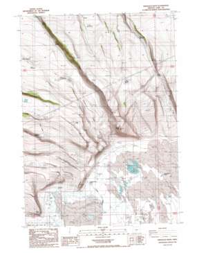
Sheeplick Draw Topo Map Oregon
To zoom in, hover over the map of Sheeplick Draw
USGS Topo Quad 43120a6 - 1:24,000 scale
| Topo Map Name: | Sheeplick Draw |
| USGS Topo Quad ID: | 43120a6 |
| Print Size: | ca. 21 1/4" wide x 27" high |
| Southeast Coordinates: | 43° N latitude / 120.625° W longitude |
| Map Center Coordinates: | 43.0625° N latitude / 120.6875° W longitude |
| U.S. State: | OR |
| Filename: | o43120a6.jpg |
| Download Map JPG Image: | Sheeplick Draw topo map 1:24,000 scale |
| Map Type: | Topographic |
| Topo Series: | 7.5´ |
| Map Scale: | 1:24,000 |
| Source of Map Images: | United States Geological Survey (USGS) |
| Alternate Map Versions: |
Sheeplick Draw OR 1986, updated 1986 Download PDF Buy paper map Sheeplick Draw OR 2011 Download PDF Buy paper map Sheeplick Draw OR 2014 Download PDF Buy paper map |
1:24,000 Topo Quads surrounding Sheeplick Draw
> Back to 43120a1 at 1:100,000 scale
> Back to 43120a1 at 1:250,000 scale
> Back to U.S. Topo Maps home
Sheeplick Draw topo map: Gazetteer
Sheeplick Draw: Cliffs
Klippel Point elevation 1417m 4648′Sheeplick Draw: Flats
Juniper Lake elevation 1670m 5479′Rock Lake elevation 1585m 5200′
Sheeplick Lake elevation 1529m 5016′
Twin Lakes elevation 1539m 5049′
Sheeplick Draw: Lakes
Squaw Lake elevation 1543m 5062′Sheeplick Draw: Reservoirs
Big Reservoir elevation 1558m 5111′Guinee Reservoir Number 1 elevation 1520m 4986′
Guinee Reservoir Number 2 elevation 1486m 4875′
New Waterhole elevation 1564m 5131′
O'Leary Reservoir Number 1 elevation 1568m 5144′
O'Leary Reservoir Number 3 elevation 1600m 5249′
Pattern Reservoir elevation 1496m 4908′
Peter Creek Reservoir elevation 1586m 5203′
Sheeplick Draw: Springs
Deadhorse Spring elevation 1306m 4284′Johnson Creek Spring elevation 1306m 4284′
Sheeplick Draw: Streams
Johnson Creek elevation 1293m 4242′Sheeplick Draw: Summits
Flatiron Point elevation 1652m 5419′Squaw Butte elevation 1636m 5367′
Sheeplick Draw: Valleys
Sheeplick Draw elevation 1313m 4307′Watson Draw elevation 1404m 4606′
Sheeplick Draw: Wells
Hale Well elevation 1300m 4265′Harney Well elevation 1301m 4268′
Hinton Well elevation 1300m 4265′
Klippel Well elevation 1296m 4251′
Sedora Well elevation 1303m 4274′
Swanton Well elevation 1305m 4281′
Sheeplick Draw digital topo map on disk
Buy this Sheeplick Draw topo map showing relief, roads, GPS coordinates and other geographical features, as a high-resolution digital map file on DVD:


