Christmas Valley Topo Map Oregon
To zoom in, hover over the map of Christmas Valley
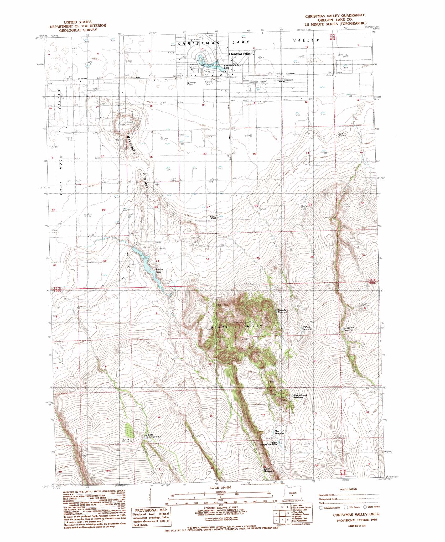
USGS Topo Quad 43120b6 - 1:24,000 scale
| Topo Map Name: | Christmas Valley |
| USGS Topo Quad ID: | 43120b6 |
| Print Size: | ca. 21 1/4" wide x 27" high |
| Southeast Coordinates: | 43.125° N latitude / 120.625° W longitude |
| Map Center Coordinates: | 43.1875° N latitude / 120.6875° W longitude |
| U.S. State: | OR |
| Filename: | o43120b6.jpg |
| Download Map JPG Image: | Christmas Valley topo map 1:24,000 scale |
| Map Type: | Topographic |
| Topo Series: | 7.5´ |
| Map Scale: | 1:24,000 |
| Source of Map Images: | United States Geological Survey (USGS) |
| Alternate Map Versions: |
Christmas Valley OR 1986, updated 1986 Download PDF Buy paper map Christmas Valley OR 2011 Download PDF Buy paper map Christmas Valley OR 2014 Download PDF Buy paper map |
1:24,000 Topo Quads surrounding Christmas Valley
Cougar Mountain |
Hogback Butte |
Jacks Place |
Peters Creek Sink |
Mean Rock Well |
Schaub Lake |
Lane Lake |
Crack In The Ground |
Christmas Lake |
Fossil Lake |
Tuff Butte |
Thorn Lake |
Christmas Valley |
Fandango Canyon |
Vaughn Well |
Duncan Reservoir |
Egli Rim |
Sheeplick Draw |
Saint Patrick Mountain |
Sheep Rock |
Foster Butte |
Summer Lake |
Ana River |
Diablo Peak |
Bull Lake |
> Back to 43120a1 at 1:100,000 scale
> Back to 43120a1 at 1:250,000 scale
> Back to U.S. Topo Maps home
Christmas Valley topo map: Gazetteer
Christmas Valley: Airports
Christmas Valley Airstrip elevation 1316m 4317′Christmas Valley: Dams
Sevan Dam elevation 1350m 4429′Christmas Valley: Lakes
Christmas Valley Lake elevation 1316m 4317′Christmas Valley: Populated Places
Christmas Valley elevation 1317m 4320′Christmas Valley: Post Offices
Christmas Valley Post Office elevation 1317m 4320′Lake Post Office (historical) elevation 1318m 4324′
Christmas Valley: Ranges
Black Hills elevation 1558m 5111′Christmas Valley: Reservoirs
Blue Reservoir elevation 1551m 5088′Boundary Reservoir elevation 1444m 4737′
Coffee Pot Reservoir elevation 1512m 4960′
Guinee Reservoir Number 3 elevation 1481m 4858′
Look Reservoir elevation 1496m 4908′
Sevan Lake elevation 1350m 4429′
Sheep Corral Reservoir elevation 1534m 5032′
Upper Sheep Corral Reservoir elevation 1554m 5098′
Withers Reservoir elevation 1482m 4862′
Christmas Valley: Ridges
Sevenmile Ridge elevation 1324m 4343′Christmas Valley digital topo map on disk
Buy this Christmas Valley topo map showing relief, roads, GPS coordinates and other geographical features, as a high-resolution digital map file on DVD: