Crack In The Ground Topo Map Oregon
To zoom in, hover over the map of Crack In The Ground
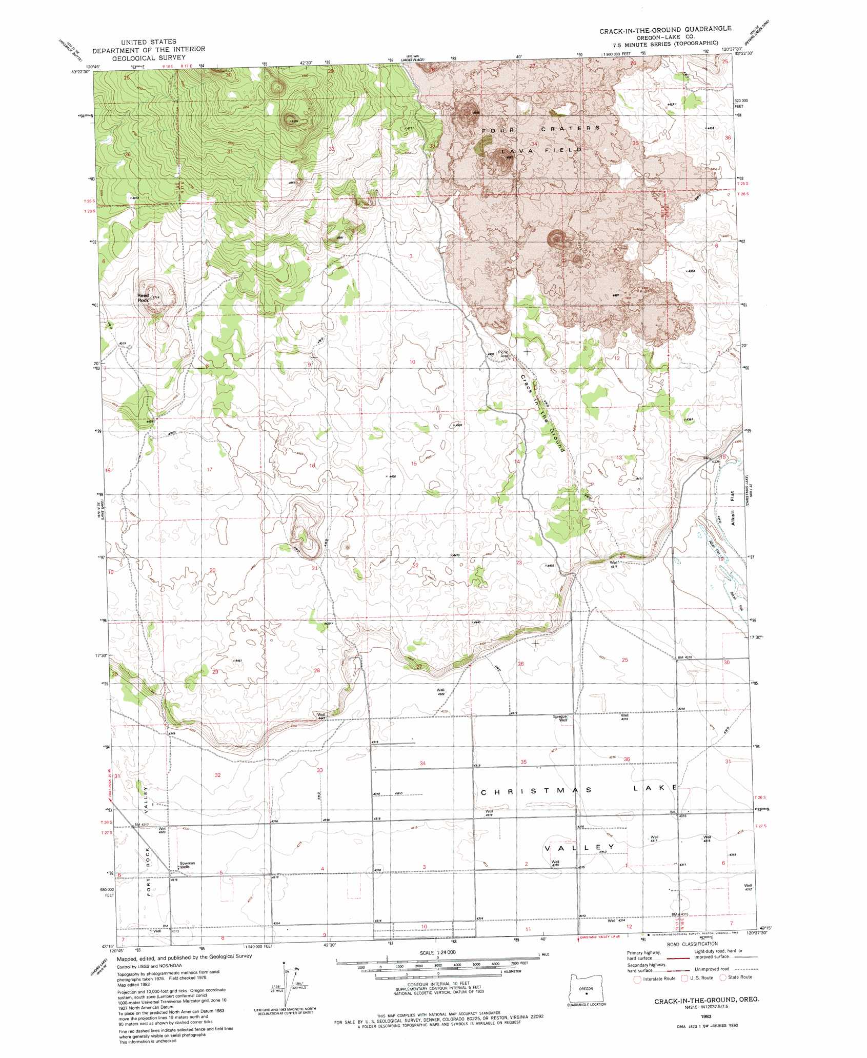
USGS Topo Quad 43120c6 - 1:24,000 scale
| Topo Map Name: | Crack In The Ground |
| USGS Topo Quad ID: | 43120c6 |
| Print Size: | ca. 21 1/4" wide x 27" high |
| Southeast Coordinates: | 43.25° N latitude / 120.625° W longitude |
| Map Center Coordinates: | 43.3125° N latitude / 120.6875° W longitude |
| U.S. State: | OR |
| Filename: | o43120c6.jpg |
| Download Map JPG Image: | Crack In The Ground topo map 1:24,000 scale |
| Map Type: | Topographic |
| Topo Series: | 7.5´ |
| Map Scale: | 1:24,000 |
| Source of Map Images: | United States Geological Survey (USGS) |
| Alternate Map Versions: |
Crack-in-the-Ground OR 1983, updated 1983 Download PDF Buy paper map Crack In The Ground OR 2011 Download PDF Buy paper map Crack In The Ground OR 2014 Download PDF Buy paper map |
1:24,000 Topo Quads surrounding Crack In The Ground
Sixteen Butte |
Fox Butte |
Walker Butte |
Last Chance Lake |
Frederick Butte |
Cougar Mountain |
Hogback Butte |
Jacks Place |
Peters Creek Sink |
Mean Rock Well |
Schaub Lake |
Lane Lake |
Crack In The Ground |
Christmas Lake |
Fossil Lake |
Tuff Butte |
Thorn Lake |
Christmas Valley |
Fandango Canyon |
Vaughn Well |
Duncan Reservoir |
Egli Rim |
Sheeplick Draw |
Saint Patrick Mountain |
Sheep Rock |
> Back to 43120a1 at 1:100,000 scale
> Back to 43120a1 at 1:250,000 scale
> Back to U.S. Topo Maps home
Crack In The Ground topo map: Gazetteer
Crack In The Ground: Lavas
Four Craters Lava Field elevation 1395m 4576′Crack In The Ground: Summits
Reed Rock elevation 1437m 4714′South Green Mountain elevation 1480m 4855′
Crack In The Ground: Valleys
Crack in the Ground elevation 1360m 4461′Crack In The Ground: Wells
Bowman Wells elevation 1317m 4320′Sprague Well elevation 1316m 4317′
Crack In The Ground digital topo map on disk
Buy this Crack In The Ground topo map showing relief, roads, GPS coordinates and other geographical features, as a high-resolution digital map file on DVD: