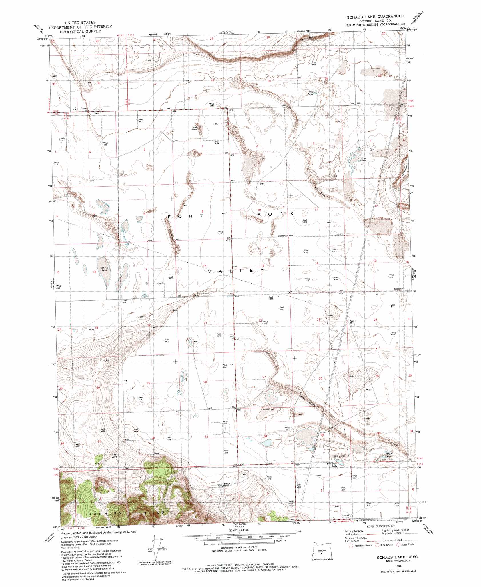
Schaub Lake Topo Map Oregon
To zoom in, hover over the map of Schaub Lake
USGS Topo Quad 43120c8 - 1:24,000 scale
| Topo Map Name: | Schaub Lake |
| USGS Topo Quad ID: | 43120c8 |
| Print Size: | ca. 21 1/4" wide x 27" high |
| Southeast Coordinates: | 43.25° N latitude / 120.875° W longitude |
| Map Center Coordinates: | 43.3125° N latitude / 120.9375° W longitude |
| U.S. State: | OR |
| Filename: | o43120c8.jpg |
| Download Map JPG Image: | Schaub Lake topo map 1:24,000 scale |
| Map Type: | Topographic |
| Topo Series: | 7.5´ |
| Map Scale: | 1:24,000 |
| Source of Map Images: | United States Geological Survey (USGS) |
| Alternate Map Versions: |
Schaub Lake OR 1982, updated 1982 Download PDF Buy paper map Schaub Lake OR 2011 Download PDF Buy paper map Schaub Lake OR 2014 Download PDF Buy paper map |
1:24,000 Topo Quads surrounding Schaub Lake
Indian Butte |
South Ice Cave |
Sixteen Butte |
Fox Butte |
Walker Butte |
Hole In The Ground |
Cabin Lake |
Cougar Mountain |
Hogback Butte |
Jacks Place |
Mccarty Butte |
Fort Rock |
Schaub Lake |
Lane Lake |
Crack In The Ground |
Oatman Flat |
Silver Lake |
Tuff Butte |
Thorn Lake |
Christmas Valley |
Bridge Creek Draw |
Hager Mountain |
Duncan Reservoir |
Egli Rim |
Sheeplick Draw |
> Back to 43120a1 at 1:100,000 scale
> Back to 43120a1 at 1:250,000 scale
> Back to U.S. Topo Maps home
Schaub Lake topo map: Gazetteer
Schaub Lake: Basins
Fort Rock Valley elevation 1317m 4320′Schaub Lake: Flats
Cream Lake elevation 1318m 4324′Dog Lake elevation 1316m 4317′
McCall Lake elevation 1310m 4297′
Schaub Lake elevation 1315m 4314′
Windmill Lake elevation 1312m 4304′
Schaub Lake: Lakes
Christmas Lake elevation 1313m 4307′Schaub Lake: Post Offices
Connley Post Office (historical) elevation 1316m 4317′Woodrow Post Office (historical) elevation 1317m 4320′
Schaub Lake: Reservoirs
Parks Reservoir elevation 1385m 4543′Schaub Lake digital topo map on disk
Buy this Schaub Lake topo map showing relief, roads, GPS coordinates and other geographical features, as a high-resolution digital map file on DVD: