Tired Horse Butte Topo Map Oregon
To zoom in, hover over the map of Tired Horse Butte
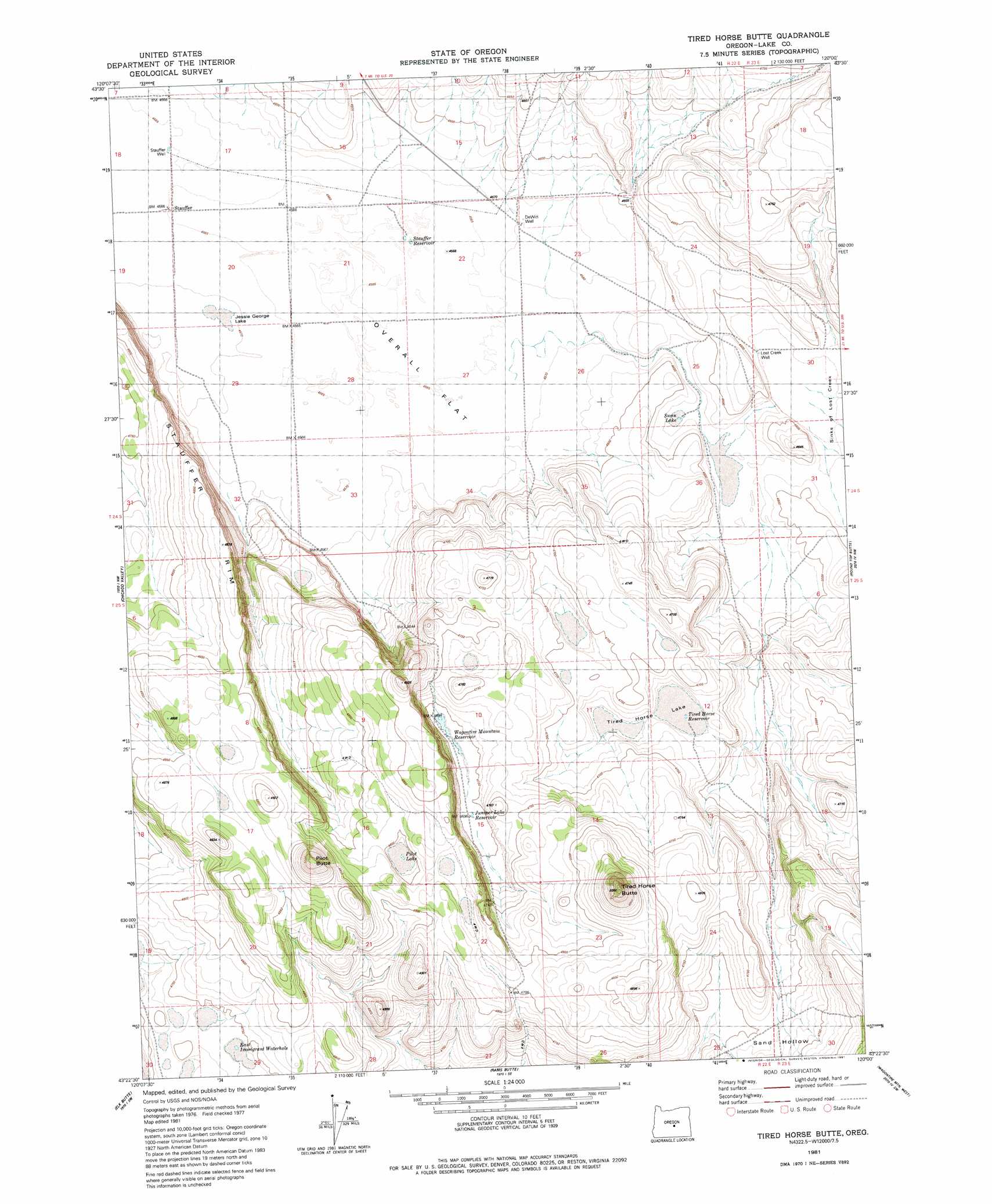
USGS Topo Quad 43120d1 - 1:24,000 scale
| Topo Map Name: | Tired Horse Butte |
| USGS Topo Quad ID: | 43120d1 |
| Print Size: | ca. 21 1/4" wide x 27" high |
| Southeast Coordinates: | 43.375° N latitude / 120° W longitude |
| Map Center Coordinates: | 43.4375° N latitude / 120.0625° W longitude |
| U.S. State: | OR |
| Filename: | o43120d1.jpg |
| Download Map JPG Image: | Tired Horse Butte topo map 1:24,000 scale |
| Map Type: | Topographic |
| Topo Series: | 7.5´ |
| Map Scale: | 1:24,000 |
| Source of Map Images: | United States Geological Survey (USGS) |
| Alternate Map Versions: |
Tired Horse Butte OR 1981, updated 1981 Download PDF Buy paper map Tired Horse Butte OR 2011 Download PDF Buy paper map Tired Horse Butte OR 2014 Download PDF Buy paper map |
1:24,000 Topo Quads surrounding Tired Horse Butte
West Of Hampston |
Hampton |
Misery Flat |
Dust Bowl |
Bulger Ridge |
Benjamin Lake |
Potato Lake |
Glass Butte |
Hat Butte |
Potato Hills |
Moonlight Butte |
Chicago Valley |
Tired Horse Butte |
Round Top Butte |
Hay Lake |
Sand Rock |
Elk Butte |
Rams Butte |
Wagontire Mountain West |
Wagontire Mountain East |
Buffalo Well |
Horse Mountain |
Goodrich Well |
Locust Butte |
Little Juniper Mountain |
> Back to 43120a1 at 1:100,000 scale
> Back to 43120a1 at 1:250,000 scale
> Back to U.S. Topo Maps home
Tired Horse Butte topo map: Gazetteer
Tired Horse Butte: Basins
Sand Hollow elevation 1436m 4711′Tired Horse Butte: Cliffs
Stauffer Rim elevation 1465m 4806′Tired Horse Butte: Post Offices
Stauffer Post Office (historical) elevation 1393m 4570′Tired Horse Butte: Reservoirs
East Immigrant Waterhole elevation 1446m 4744′Juniper Lake Reservoir elevation 1432m 4698′
Pilot Lake Reservoir elevation 1461m 4793′
Stauffer Reservoir elevation 1393m 4570′
Tired Horse Reservoir elevation 1420m 4658′
Wagontire Mountain Reservoir elevation 1430m 4691′
Tired Horse Butte: Streams
Lost Creek elevation 1397m 4583′Tired Horse Butte: Summits
Pilot Butte elevation 1515m 4970′Tired Horse Butte elevation 1544m 5065′
Tired Horse Butte: Wells
De Witt Well elevation 1395m 4576′Lost Creek Well elevation 1397m 4583′
Stauffer Well elevation 1393m 4570′
Tired Horse Butte digital topo map on disk
Buy this Tired Horse Butte topo map showing relief, roads, GPS coordinates and other geographical features, as a high-resolution digital map file on DVD: