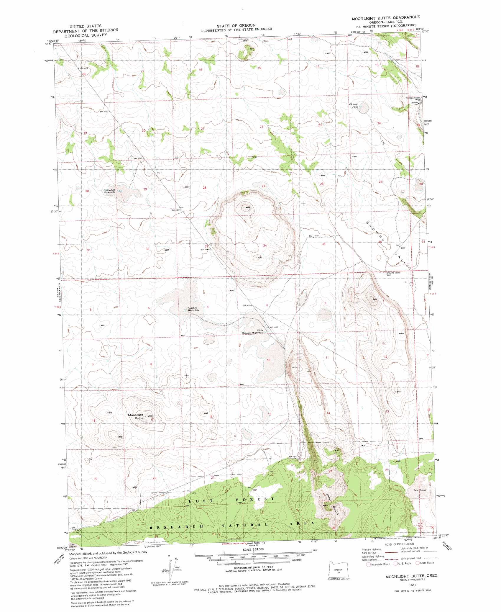
Moonlight Butte Topo Map Oregon
To zoom in, hover over the map of Moonlight Butte
USGS Topo Quad 43120d3 - 1:24,000 scale
| Topo Map Name: | Moonlight Butte |
| USGS Topo Quad ID: | 43120d3 |
| Print Size: | ca. 21 1/4" wide x 27" high |
| Southeast Coordinates: | 43.375° N latitude / 120.25° W longitude |
| Map Center Coordinates: | 43.4375° N latitude / 120.3125° W longitude |
| U.S. State: | OR |
| Filename: | o43120d3.jpg |
| Download Map JPG Image: | Moonlight Butte topo map 1:24,000 scale |
| Map Type: | Topographic |
| Topo Series: | 7.5´ |
| Map Scale: | 1:24,000 |
| Source of Map Images: | United States Geological Survey (USGS) |
| Alternate Map Versions: |
Moonlight Butte OR 1981, updated 1981 Download PDF Buy paper map Moonlight Butte OR 2011 Download PDF Buy paper map Moonlight Butte OR 2014 Download PDF Buy paper map |
1:24,000 Topo Quads surrounding Moonlight Butte
Soldiers Gap |
Imperial Valley South |
West Of Hampston |
Hampton |
Misery Flat |
Last Chance Lake |
Frederick Butte |
Benjamin Lake |
Potato Lake |
Glass Butte |
Peters Creek Sink |
Mean Rock Well |
Moonlight Butte |
Chicago Valley |
Tired Horse Butte |
Christmas Lake |
Fossil Lake |
Sand Rock |
Elk Butte |
Rams Butte |
Fandango Canyon |
Vaughn Well |
Buffalo Well |
Horse Mountain |
Goodrich Well |
> Back to 43120a1 at 1:100,000 scale
> Back to 43120a1 at 1:250,000 scale
> Back to U.S. Topo Maps home
Moonlight Butte topo map: Gazetteer
Moonlight Butte: Areas
Lost Forest Research Natural Area elevation 1370m 4494′Moonlight Butte: Basins
Browns Valley elevation 1403m 4603′Moonlight Butte: Dams
Benjamin Lake Dam elevation 1481m 4858′Moonlight Butte: Flats
Bull Lake elevation 1420m 4658′Moonlight Butte: Reservoirs
Bull Lake Waterhole elevation 1420m 4658′Chicago Pond elevation 1439m 4721′
Little Sagehen Waterhole elevation 1390m 4560′
Sagehen Waterhole elevation 1390m 4560′
Moonlight Butte: Summits
Moonlight Butte elevation 1445m 4740′Moonlight Butte: Wells
Browns Valley Well elevation 1403m 4603′Chicago Valley Well elevation 1419m 4655′
Moonlight Butte digital topo map on disk
Buy this Moonlight Butte topo map showing relief, roads, GPS coordinates and other geographical features, as a high-resolution digital map file on DVD: