Glass Butte Topo Map Oregon
To zoom in, hover over the map of Glass Butte
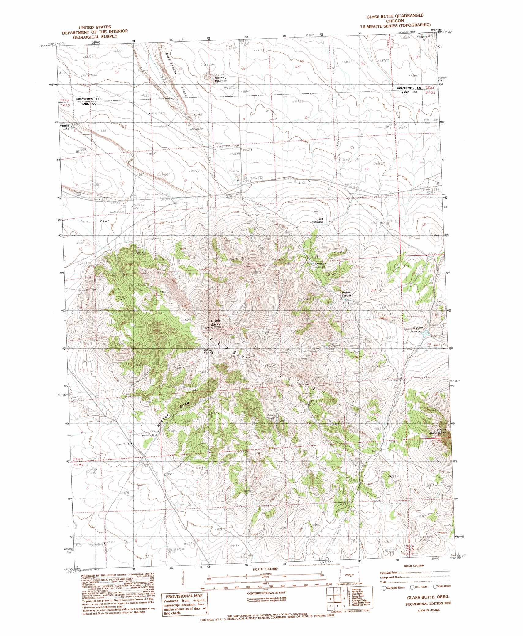
USGS Topo Quad 43120e1 - 1:24,000 scale
| Topo Map Name: | Glass Butte |
| USGS Topo Quad ID: | 43120e1 |
| Print Size: | ca. 21 1/4" wide x 27" high |
| Southeast Coordinates: | 43.5° N latitude / 120° W longitude |
| Map Center Coordinates: | 43.5625° N latitude / 120.0625° W longitude |
| U.S. State: | OR |
| Filename: | o43120e1.jpg |
| Download Map JPG Image: | Glass Butte topo map 1:24,000 scale |
| Map Type: | Topographic |
| Topo Series: | 7.5´ |
| Map Scale: | 1:24,000 |
| Source of Map Images: | United States Geological Survey (USGS) |
| Alternate Map Versions: |
Glass Butte OR 1983, updated 1983 Download PDF Buy paper map Glass Buttes OR 2011 Download PDF Buy paper map Glass Buttes OR 2014 Download PDF Buy paper map |
1:24,000 Topo Quads surrounding Glass Butte
Hampton Butte |
Long Barn |
G. I. Ranch |
Ibex Butte |
Mackey Butte |
West Of Hampston |
Hampton |
Misery Flat |
Dust Bowl |
Bulger Ridge |
Benjamin Lake |
Potato Lake |
Glass Butte |
Hat Butte |
Potato Hills |
Moonlight Butte |
Chicago Valley |
Tired Horse Butte |
Round Top Butte |
Hay Lake |
Sand Rock |
Elk Butte |
Rams Butte |
Wagontire Mountain West |
Wagontire Mountain East |
> Back to 43120e1 at 1:100,000 scale
> Back to 43120a1 at 1:250,000 scale
> Back to U.S. Topo Maps home
Glass Butte topo map: Gazetteer
Glass Butte: Flats
Overall Flat elevation 1422m 4665′Perry flat elevation 1363m 4471′
Glass Butte: Reservoirs
Bald Waterhole elevation 1442m 4730′Campground Reservoir elevation 1481m 4858′
Highway Waterhole elevation 1367m 4484′
Musser Reservoir elevation 1416m 4645′
Pausch Lake elevation 1370m 4494′
Question Reservoir elevation 1566m 5137′
Swale Reservoir elevation 1610m 5282′
The Tank elevation 1308m 4291′
Glass Butte: Springs
Cabin Spring elevation 1614m 5295′Chesebro Spring elevation 1523m 4996′
Dribble Spring elevation 1526m 5006′
Robins Spring elevation 1690m 5544′
Glass Butte: Summits
Buck Butte elevation 1538m 5045′Glass Butte elevation 1946m 6384′
Glass Buttes elevation 1882m 6174′
Glass Butte: Valleys
Musser Draw elevation 1470m 4822′Glass Butte: Wells
Musser Well elevation 1470m 4822′Glass Butte digital topo map on disk
Buy this Glass Butte topo map showing relief, roads, GPS coordinates and other geographical features, as a high-resolution digital map file on DVD: